Varadka | |
|---|---|
Municipality | |
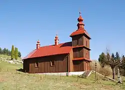 Wooden church in village | |
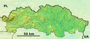 Varadka Location of Varadka in the Prešov Region 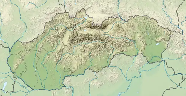 Varadka Location of Varadka in Slovakia | |
| Coordinates: 49°24′45″N 21°23′0″E / 49.41250°N 21.38333°E | |
| Country | |
| Region | Prešov |
| District | Bardejov |
| First mentioned | 1492 |
| Area | |
| • Total | 7.374 km2 (2.847 sq mi) |
| Elevation | 409 m (1,342 ft) |
| Population | |
| • Total | 175 |
| • Density | 24/km2 (61/sq mi) |
| Time zone | UTC+1 (CET) |
| • Summer (DST) | UTC+2 (CEST) |
| Postal code | 086 36 (pošta Nižná Polianka) |
| Area code | +421 (0)54 |
| Car plate | BJ |
| Website | www |
Varadka is a village and municipality in Bardejov District in the Prešov Region of north-east Slovakia.
History
In historical records the village was first mentioned in 1492
Geography
The municipality lies at an altitude of 409 metres and covers an area of 7.374 km². It has a population of about 175 people.
External links
 Media related to Varadka at Wikimedia Commons
- Official website

- http://www.statistics.sk/mosmis/eng/run.html
This article is issued from Wikipedia. The text is licensed under Creative Commons - Attribution - Sharealike. Additional terms may apply for the media files.