Veracruz metropolitan area
Zona Metropolitana de Veracruz | |
|---|---|
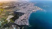 Aerial view of Veracruz metro area | |
 Seal | |
| Country | Mexico |
| State | Veracruz |
| Core city | Veracruz (city) |
| Municipalities | List
|
| Area | |
| • Total | 1,888.8 km2 (729.3 sq mi) |
| Population (2020) | |
| • Total | 939,046 |
| • Density | 500/km2 (1,300/sq mi) |
| Time zone | UTC-6 (Zona Centro = U.S. CST) |
| • Summer (DST) | UTC-6 (Zona Centro = U.S. CST) |
| LADA | 229 |
The Veracruz metropolitan area (Zona metropolitana de Veracruz, ZMV) is a metropolitan area in Veracruz (state), Mexico formed by the city of Veracruz and its Veracruz municipality and five other municipalities.
According to the 2020 Census by the INEGI and published in 2021, the Veracruz metropolitan area had 939,046 inhabitants, the twentieth largest in Mexico, and in the most populated of the state of Veracruz.[1] It fits to stand out that it presents a populational growth sustained #turn an axis of the region, since it considers him like the most important of the State of Veracruz and also of the gulf of Mexico.
Component municipios and localidades
The metropolitan area consists of 6 municipalities, roughly equivalent to U.S. counties in that they each contain multiple (localidades, places) such as cities, towns, and villages.
| Municipality |
|---|
| Veracruz |
| Boca del Río |
| Medellín |
| Alvarado |
| Jamapa |
| Manlio Fabio Altamirano |
Localidades
The 15 largest localidades are:
| Localidad | Municipio | Population |
|---|---|---|
| Veracruz (localidad, Veracruz mun.)[2] | Veracruz | 405,952 |
| Veracruz (localidad, Boca del Río mun.)[3] | Boca del Río | 132,011 |
| Valente Díaz[4] | Veracruz | 36,818 |
| Fraccionamiento Puente Moreno[5] | Medellín | 34,913 |
| Lomas de Río Medio Cuatro | Veracruz | 20,849 |
| Alvarado[6] | Alvarado | 20,797 |
| Fraccionamiento Geovillas los Pinos[7] | Veracruz | 16,855 |
| Las Amapolas[8] | Veracruz | 15,076 |
| Hacienda Sotavento | Veracruz | 11,583 |
| El Tejar[9] | Medellín | 11,144 |
| Los Torrentes[10] | Veracruz | 10,870 |
| Boca del Río[11] | Boca del Río | 9,988 |
| Colinas de Santa Fe[12] | Veracruz | 9,205 |
| Fraccionamiento Arboledas San Ramón[13] | Medellín | 8,894 |
| Valle Alto | Veracruz | 6,688 |
Gallery
 Playa Villa del Mar, Veracruz
 Boulevard Manuel Ávila Camacho, Veracruz
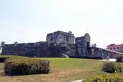 Baluarte de Santiago, Veracruz
 Teatro de la Reforma, Veracruz
 Malecón, Veracruz
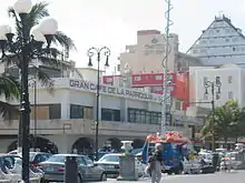 Gran Café de La Parroquia, Veracruz
 Faro de Venustiano Carranza, Veracruz
 Registro Civil, Veracruz
 Monument to the defense against the U.S. invasion of Veracruz of 1914(es)
 Palacio Federal, Veracruz
 Archives and library, Veracruz
 Los portales de Lerdo, Veracruz
 Las Atarazanas, Veracruz
 Fortaleza de San Juan de Ulúa, Veracruz
 Torre de PEMEX tower, Veracruz
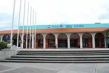 Aquarium, Veracruz
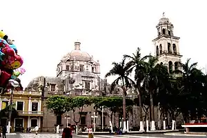 Cathedral, Veracruz
 Veracruz airport
 Tourist area of Veracruz
 Puente de la Amistad bridge
 Sunset and sea view in Veracruz
 Boulevard Miguel Alemán, Veracruz
 Boulevard Manuel Ávila Camacho, Veracruz
 Boca del Río city hall
 Zócalo, Boca del Río
 Malecón, Boca del Río
 Río Jamapa, Boca del Río
 Alvarado city hall
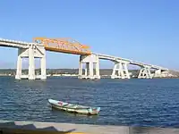 Alvarado bridge
 Monumento a los Héroes de Sotavento and Parroquia de Nuestra Señora del Rosario in Alvarado.
 Beach, Antón Lizardo
 Church, Antón Lizardo
.jpg.webp) Ruins of Antón Lizardo
Ruins of Antón Lizardo
See also
References
- ↑ INEGI - Delimitación de las Zonas Metropolitanas de México 2010.
- ↑ "Catálogo Localidades". web.archive.org. SEDESOL. 24 October 2021. Retrieved 12 December 2023.
- ↑ "Catálogo Localidades". web.archive.org. SEDESOL. 23 October 2021. Retrieved 12 December 2023.
- ↑ "Catálogo Localidades". web.archive.org. SEDESOL. 24 October 2021. Retrieved 12 December 2023.
- ↑ "Catálogo Localidades". web.archive.org. SEDESOL. 23 October 2021. Retrieved 12 December 2023.
- ↑ "Catálogo Localidades". web.archive.org. SEDESOL. 23 October 2021. Retrieved 12 December 2023.
- ↑ "Catálogo Localidades". web.archive.org. SEDESOL. 24 October 2021. Retrieved 12 December 2023.
- ↑ "Catálogo Localidades". web.archive.org. SEDESOL. 23 October 2021. Retrieved 12 December 2023.
- ↑ SEDESOL - Localidad de El Tejar.
- ↑ SEDESOL - Localidad de Los Torrentes.
- ↑ SEDESOL - Localidad de Boca del Río.
- ↑ SEDESOL - Localidad de Colinas de Santa Fe.
- ↑ SEDESOL - Localidad de Fraccionamiento Arboledas San Ramón.