Vledderveen | |
|---|---|
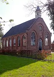
 Church in 2010 | |
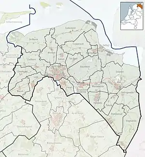
 Vledderveen Location in the province of Groningen in the Netherlands  Vledderveen Vledderveen (Netherlands) | |
| Coordinates: 52°59′10″N 7°0′28″E / 52.98611°N 7.00778°E | |
| Country | Netherlands |
| Province | Groningen |
| Municipality | Stadskanaal |
| Established | 1880 |
| Area | |
| • Total | 2.84 km2 (1.10 sq mi) |
| Elevation | 5 m (16 ft) |
| Population (2021)[1] | |
| • Total | 295 |
| • Density | 100/km2 (270/sq mi) |
| Postal code | 9585 |
| Area code | 0599 |
Vledderveen (also: Vledderbatten) is a village in the Dutch province of Groningen. It is located in the municipality of Stadskanaal, about 3 km east of the centre of that town.[3]
Vledderveen was established on 21 June 1880 to cultivate the heath. It used by inhabited by shepherd Minne Kone, his dog and 2,000 sheep.[4] It was originally called Vledderbatten.[5] In 1903, a school opened in Vledderveen. It was closed in the late 20th century due to lack of students.[4]
In 1961, Stadskanaal Airfield was built in Vledderveen.[6] In 1969, a motocross club was established. The former landfill near the village was used as a track, however the neighbours complained about the noise. It was decided to build a motocross circuit next to the airfield.[5]
References
- 1 2 "Kerncijfers wijken en buurten 2021". Central Bureau Statistics. Retrieved 28 February 2022.
- ↑ "Postcodetool for 9585PA". Actueel Hoogtebestand Nederland (in Dutch). Het Waterschapshuis. Retrieved 28 February 2022.
- ↑ ANWB Topografische Atlas Nederland, Topografische Dienst and ANWB, 2005.
- 1 2 "In Vledderveen is saamhorigheid belangrijker dan voorzieningen". Nieuwsblad van het Noorden (in Dutch). 18 June 1980. Retrieved 28 February 2022.
- 1 2 "Vledderveen Groningen". Plaatsengids (in Dutch). Retrieved 28 February 2022.
- ↑ "Stadskanaal airfield". Avia Dejavu (in Dutch). Retrieved 28 February 2022.
External links
 Media related to Vledderveen, Groningen at Wikimedia Commons