Vlodrop-station | |
|---|---|
Hamlet | |
 Former railway line | |
 Vlodrop-station Location in the Netherlands  Vlodrop-station Location in the province of Limburg in the Netherlands | |
| Coordinates: 51°9′6″N 6°9′0″E / 51.15167°N 6.15000°E | |
| Country | Netherlands |
| Province | Limburg |
| Municipality | Roerdalen |
| Area | |
| • Total | 0.01 km2 (0.004 sq mi) |
| Population (2021)[1] | |
| • Total | 10 |
| • Density | 1,000/km2 (2,600/sq mi) |
| Time zone | UTC+1 (CET) |
| • Summer (DST) | UTC+2 (CEST) |
| Postal code | 6063[1] |
| Dialing code | 0475 |
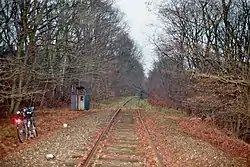
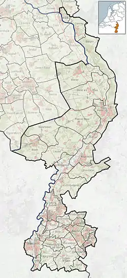
Vlodrop-station (Limburgish and town dialect: Vlórp-Statie) is a hamlet in the Dutch province of Limburg. It is located on the German border, about 5 km (3.1 mi) east of the village Vlodrop, in the municipality of Roerdalen.
The hamlet is named after the railway station of Vlodrop, which was located on the Iron Rhine connection between Antwerp, Belgium, and locations in Germany. The location was chosen because the Belgian owners of the railway line could get free land there, and because of the proximity to the border meant that customs officers had extra powers.[2] The station was bombed in 1944, and never rebuilt.[3]
References
- 1 2 3 "Kerncijfers wijken en buurten 2021". Central Bureau of Statistics. Retrieved 25 April 2022.
- ↑ Stationsweb, station Vlodrop, http://stationsweb.brinkster.net/station.asp?station=vlodrop
- ↑ "station Vlodrop". Stationweb (in Dutch). Retrieved 25 April 2022.
This article is issued from Wikipedia. The text is licensed under Creative Commons - Attribution - Sharealike. Additional terms may apply for the media files.