Volthe | |
|---|---|
Hamlet | |
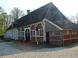
 Havezathe het Everlo in Volthe | |
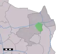
 Volthe in the municipality of Dinkelland. | |
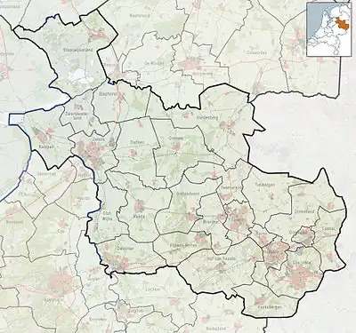
 Volthe Location in the Netherlands  Volthe Volthe (Netherlands) | |
| Coordinates: 52°22′15″N 6°56′47″E / 52.37083°N 6.94639°E | |
| Country | Netherlands |
| Province | Overijssel |
| Municipality | Dinkelland |
| Elevation | 25 m (82 ft) |
| Demonym(s) | Volthenaren, Öllieböarde |
| Time zone | UTC+1 (CET) |
| • Summer (DST) | UTC+2 (CEST) |
| Postal code | 7596 |
| Dialing code | 0541 |
Volthe is a hamlet in the Dutch province of Overijssel. It is a part of the municipality of Dinkelland, and lies about 6 km north of Oldenzaal.
Volthe is not a statistical entity,[2] and the postal authorities have placed it under Rossum.[3] It was first mentioned in the late-10th century as Uuluht. The etymology is unclear.[4] In 1840, it was home to 542. Nowadays, it consists of about 200 houses.[5]
It is a rural area with spread out farms and houses, some of them in the timber framed style of the traditional Low German house.
A fortified house, het Everlo, serves as a starting point for walks to the nearby nature reserve Roderveld.
Gallery
 Traditional cottage
 Barn with wagon
 Shedded entrance of a barn
References
- ↑ "Postcodetool for 7596JA". Actueel Hoogtebestand Nederland (in Dutch). Het Waterschapshuis. Retrieved 15 March 2022.
- ↑ "Kerncijfers wijken en buurten 2021". Central Bureau of Statistics. Retrieved 15 March 2022.
Not found
- ↑ "Postcode 7596 in Rossum". Postcode bij adres (in Dutch). Retrieved 15 March 2022.
- ↑ "Volthe - (geografische naam)". Etymologiebank (in Dutch). Retrieved 15 March 2022.
- ↑ "Volthe". Plaatsengids (in Dutch). Retrieved 15 March 2022.
This article is issued from Wikipedia. The text is licensed under Creative Commons - Attribution - Sharealike. Additional terms may apply for the media files.