Wabash and Erie Canal Culvert #100 | |
 Edge of the Burnett's Creek Arch, June 2011 | |
   | |
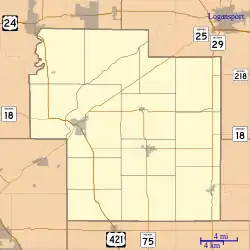
| Location | Towpath Rd. at Lockport, Adams Township, Carroll County, Indiana |
|---|---|
| Coordinates | 40°42′11″N 86°34′2″W / 40.70306°N 86.56722°W |
| Area | 0.1 acres (0.040 ha) |
| Built | 1840 |
| Built by | Case, Reed |
| Architectural style | masonry arch |
| NRHP reference No. | 02000194[1] |
| Added to NRHP | March 20, 2002 |
Wabash and Erie Canal Culvert #100, also known as Burnett's Creek Arch and County Bridge #181, is a historic culvert built for the Wabash and Erie Canal and located at Adams Township, Carroll County, Indiana. It was built in 1840, and is a semicircular span measuring 20 feet long, 10 feet high, and 87 feet, 6 inches wide. It is constructed of limestone slabs. The culvert now supports a county roadway.[2]: 5
It was listed on the National Register of Historic Places in 2002.[1]
References
- 1 2 "National Register Information System". National Register of Historic Places. National Park Service. July 9, 2010.
- ↑ "Indiana State Historic Architectural and Archaeological Research Database (SHAARD)" (Searchable database). Department of Natural Resources, Division of Historic Preservation and Archaeology. Retrieved 2015-08-01. Note: This includes Robert Conner (June 2001). "National Register of Historic Places Inventory Nomination Form: Wabash and Erie Canal Culvert #100" (PDF). Retrieved 2015-08-01. and Accompanying photographs.
This article is issued from Wikipedia. The text is licensed under Creative Commons - Attribution - Sharealike. Additional terms may apply for the media files.

