Wadgera Taluka
Wadagera Taluka Vadagera Taluk ವಡಗೇರಾ ತಾಲ್ಲೂಕು | |
|---|---|
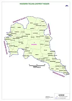
 Wadagera Taluka Map | |
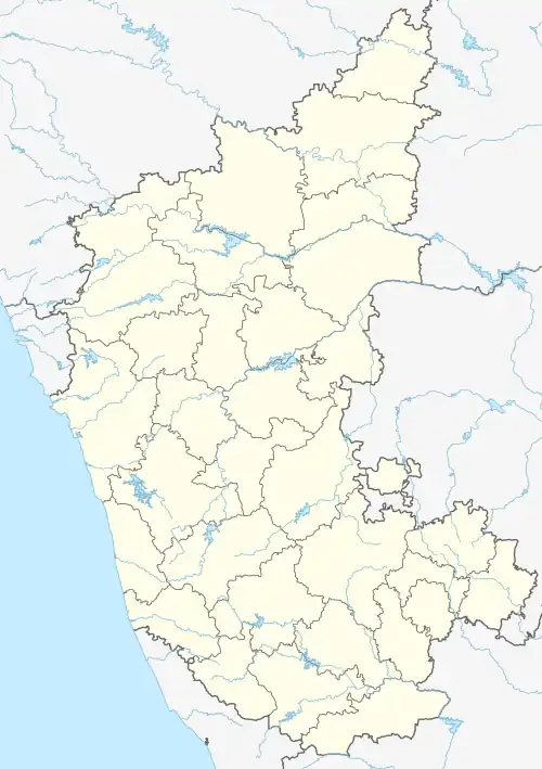
 Wadgera Taluka Location in Karnataka, India | |
| Coordinates: 16°35′11″N 77°05′54″E / 16.58639°N 77.09833°E | |
| Country | |
| State | Karnataka |
| District | Yadgir |
| Government | |
| • Type | Panchayati raj (India) |
| • Body | Taluka panchayat |
| Elevation | 383 m (1,257 ft) |
| Population (2001)[1] | |
| • Total | 7,349 |
| Languages | |
| • Official | Kannada |
| Time zone | UTC+5:30 (IST) |
| ISO 3166 code | IN-KA |
| Vehicle registration | KA 33 |
| Website | karnataka |
Wadgera is a taluka panchayat[2][3] in the southern state of Karnataka, India.[1][4] Administratively, Wadgera is in the Yadgir district in Karnataka. It was created 2017 out of the southern portion of Shahapur Taluka.[5] The administrative center is the village of Wadgera, 23 km by road south of the City of Yadgir and 39 km by road southeast of the town of Shahapur. The nearest rail station and the nearest railhead are in Yadgir.[6]
Demographics
As of 2001 India census, its chief village Wadgera had a population of 7,349 with 3,652 males and 3,697 females;[1] however, there has not been a census since the taluka was created.
Education
The government pre-university college at Wadgera has twice been shifted away to other locales.[7]
Economics
A 20 MW Solar power plant was constructed at Wadgera in 2018 by Mahindra Susten Pvt. Ltd.[8] It was owned by Hero Future Energies Ltd.
Towns and villages
Wadgera is the main village in the taluka.[4] There are 63 other villages, 18 of which are also gram panchayat villages.[9] In addition there are 55 rural habitations that don't arise to village status.[9] The gram panchayat villages include:
- Aikur
- Bendebembli
- Bilar
- Gonal
- Gulsaram
- Gundgurthi
- Hayyal (B)
- Halgera
- Kadamgera B
- Konkal
- Kurkunda
- Naikal
- Tewar Wadagera
- Tumkur
- Tadabidi
- Ullesugar
- Wadgera
References
- 1 2 3 2001 Village code= 381600 "2001 Census of India: Villages with population 5000 & above". Registrar General & Census Commissioner, India. Retrieved 18 December 2008.
- ↑ 2011 Village Panchayat Code = 221174, "Reports of National Panchayat Directory: Village Panchayat Names of, Yadgir, Karnataka". Ministry of Panchayati Raj, Government of India. Archived from the original on 27 February 2013.
- ↑ Wadagera Block Code 7389 "Wadagera Block". Local Government Directory. Ministry of Panchayati Raj, Government of India. 14 October 2019. Archived from the original on 28 November 2023.
- 1 2 2011 Census Village code = 621193, "Reports of National Panchayat Directory: List of Census Villages mapped for: Wadgera Taluka Panchayat, Yadgir, Karnataka". Registrar General & Census Commissioner, India. Archived from the original on 21 April 2013.
- ↑ DHNS (28 August 2017). "49 new taluks to be created, DCs told to fix boundaries". The Deccan Herald. Archived from the original on 28 November 2023.
- ↑ "Yadgir District Map Showing Railway Line". Yadgir District. Archived from the original on 6 February 2013.
- ↑ "Govt robs Yadgir to favour Sirsi". The Deccan Herald. 7 June 2011. Archived from the original on 3 July 2011.
- ↑ "No.16, C-1, Millers Tank Bed Area, Vasanth Nagar, Bengaluru-560 052" (PDF). Karnataka Electricity Regulatory Commission. 4 January 2023.
- 1 2 "Tehsil: Administrative Organization: Block wise". Deputy Commissioner, Yadgir, Karnataka. Archived from the original on 20 March 2023.