| Walkerwood Reservoir | |
|---|---|
 Walkerwood Reservoir and dam | |
 Walkerwood Reservoir | |
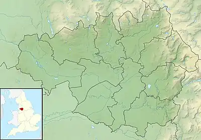
| Location | Greater Manchester |
| Coordinates | 53°29′17″N 2°01′23″W / 53.48802°N 2.02305°W |
| Type | reservoir |
| Max. depth | 61 ft (19 m) |
| Water volume | 202,084,000 US gal (764,970,000 L; 168,270,000 imp gal) |

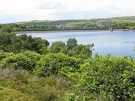
Walkerwood Reservoir (2008)
Walkerwood Reservoir is a reservoir in the Brushes valley above Stalybridge in Greater Manchester,[1] built in the 19th century to provide a supply of safe drinking water. It is owned and operated by United Utilities. [2]
The revetment was increasing vulnerable to wave action so has been strengthened by filling existing holes in the concrete with lean sand asphalt (LSA) and overlaying with open stone asphalt (OSA).[2]
Capacity
| Name | Depths of Reservoirs | Capacities of Reservoirs |
|---|---|---|
| Walkerwood Reservoir | 61 ft (19 m) | 202,084,000 US gal (764,970,000 L; 168,270,000 imp gal) |
| Brushes Reservoir | 44 ft (13 m) | 52,165,000 US gal (197,470,000 L; 43,436,000 imp gal) |
| Lower Swineshaw Reservoir | 33 ft (10 m) | 55,500,000 US gal (210,000,000 L; 46,200,000 imp gal) |
| Higher Swineshaw Reservoir | 53 ft (16 m) | 168,908,000 US gal (639,390,000 L; 140,645,000 imp gal) |
| *Total | - | 882,939,000 US gal (3.34229×10⁹ L; 735,201,000 imp gal) [3] |
See also
References
- ↑ "Seven of the best places to enjoy a reservoir walk". Manchester Evening News. M.E.N. Media. Retrieved 3 December 2016.
- 1 2 "Walkerwood Reservoir Safety Works". Asphalt Specialists In Hydraulic Engineering. UK Office : Hesselberg Hydro (1991) Ltd. Retrieved 3 December 2016.
- ↑ "Ashton under Lyne Genealogical Records". Forebears. Section:Historical description. Retrieved 3 December 2016.
This article is issued from Wikipedia. The text is licensed under Creative Commons - Attribution - Sharealike. Additional terms may apply for the media files.