| Ware Formation | |
|---|---|
| Stratigraphic range: Late Miocene-Early Pleistocene, typically Pliocene ~ | |
| Type | Geological formation |
| Unit of | Cocinetas Basin |
| Underlies | Alluvium |
| Overlies | Castilletes Formation |
| Thickness | up to 25 m (82 ft) |
| Lithology | |
| Primary | Sandstone, mudstone |
| Other | Conglomerate |
| Location | |
| Coordinates | 11°51′4.32″N 71°19′26.4″W / 11.8512000°N 71.324000°W |
| Approximate paleocoordinates | 11°42′N 70°48′W / 11.7°N 70.8°W |
| Region | La Guajira Caribbean region |
| Country | |
| Type section | |
| Named for | Wayuunaiki: "friend" |
| Named by | Moreno et al. |
| Location | Uribia |
| Year defined | 2015 |
| Coordinates | 11°51′4.32″N 71°19′26.4″W / 11.8512000°N 71.324000°W |
| Region | La Guajira |
| Country | |
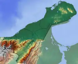
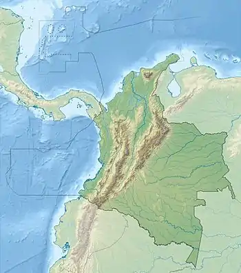
 Type locality of the formation in La Guajira | |
The Ware Formation (Spanish: Formación Ware) is a fossiliferous geological formation of the Cocinetas Basin in the northernmost department of La Guajira. The formation consists of fine lithic to quartzitic sandstones, mudstones, pebbly conglomerates with sedimentary and metamorphic rock fragments, fossiliferous packstones and sandy to conglomeratic beds with high fossil content. The Ware Formation dates to the Neogene and Quaternary periods; Late Miocene to Early Pleistocene epochs, typically Pliocene (3.5 to 2.8 Ma), Uquian, Chapadmalalan and Montehermosan in the SALMA classification, and has a maximum thickness of 25 metres (82 ft).
Etymology
The formation was defined in 2015 by Moreno et al., and given the name Ware, meaning "friend" in Wayuunaiki, the language of the local indigenous Wayuu, meaning "friend". The name has been given to pay tribute to the friendship between Colombia and Venezuela.[1]
Description
Lithologies
The Ware Formation consists of fine lithic to quartzitic sandstones, mudstones, pebbly conglomerates with sedimentary and metamorphic rock fragments, fossiliferous packstones and sandy to conglomeratic beds with high fossil content.[2]
Stratigraphy and depositional environment
The Ware Formation overlies the Castilletes Formation and is overlain by Quaternary alluvium. The age has been estimated to be Late Miocene to Early Pleistocene (5.2 to 1.22 Ma), Uquian, Chapadmalalan and Montehermosan in the SALMA classification, with a narrow definition in the Pliocene (3.5 to 2.8 Ma). The marine invertebrate fauna of the Ware Formation shows a greater similarity with modern assemblages offshore of the Guajira Peninsula than with those of the underlying units.[3] The base of the Ware Formation was deposited in a fluvio-deltaic environment, whereas the marine invertebrate assemblage at the top of the unit contains taxa typical of exposed open-ocean shoreface and nearshore settings, but with proximity to coral reef habitats. The Ware Formation correlates with the San Gregorio Formation in the Venezuelan Falcón Basin.[4]
Fossil content
| Group | Fossils | Notes |
|---|---|---|
| Mammals | Camelidae, Glyptodontidae, Pampatheriidae, Proterotheriidae, Toxodontidae, Caviidae, Erethizontidae | |
| Tardigrada gen. et sp. indet. | ||
| Mylodontidae gen. et sp. indet. | ||
| Lestodontini gen. et sp. nov. | ||
| Scelidotheriinae gen. et sp. indet., ?Hyperleptus sp. | ||
| Megalonychidae gen. et sp. nov. | ||
| Pliomegatherium lelongi | ||
| Nothrotherium sp. | ||
| Chapalmalania sp. | ||
| Hydrochoeropsis wayuu | ||
| Reptiles | Crocodylus sp., Crocodylidae indet., Alligatoridae, Podocnemididae | |
| Fish | Characidae, Cynodontidae, Serrasalmidae, Cichlidae, Sciaenidae, Doradidae, Pimelodidae, Carcharhinidae, Sphyrnidae, Myliobatidae, Pristidae | |
| Invertebrates | Argopecten sp., Euvola sp., Nodipecten sp., Crassostrea sp., Plicatula sp., Spondylus sp., Anodontia sp., Codakia sp., Bulla sp., Laevicardium sp., Trachycardium sp., Macrocallista sp. | |
See also
References
- ↑ Moreno et al., 2015, p.32
- ↑ Moreno et al., 2015, pp.32-34
- 1 2 Moreno et al., 2015, p.33
- ↑ Moreno et al., 2015, p.34
- 1 2 3 Moreno et al., 2015, p.35
- 1 2 Amson et al., 2016, p.3
- ↑ Amson et al., 2016, p.4
- ↑ Amson et al., 2016, p.7
- ↑ Amson et al., 2016, p.8
- ↑ Amson et al., 2016, p.9
- ↑ Amson et al., 2016, p.12
- ↑ Amson et al., 2016, p.15
- ↑ Pérez et al., 2017
- ↑ Police Station 470062 at Fossilworks.org
Bibliography
Local geology
- Moreno, F.; A.J.W. Hendy; L. Quiroz; N. Hoyos; D.S. Jones; V. Zapata; S. Zapata; G.A. Ballen, and Edwin Cadena, A.L. Cárdenas, J.D. Carrillo Briceño, J.D. Carrillo, D. Delgado Sierra, J. Escobar, J.I. Martínez, C. Martínez, C. Montes, J. Moreno, N. Pérez, R. Sánchez, C. Suárez, M.C. Vallejo Pareja, C. Jaramillo. 2015. Revised stratigraphy of Neogene strata in the Cocinetas Basin, La Guajira, Colombia. Swiss Journal of Palaeontology 134. 5–43. Accessed 2017-08-08.
- Rodríguez, Gabriel, and Ana Cristina Londoño. 2002. Mapa geológico del Departamento de La Guajira - 1:250,000, 1–259. INGEOMINAS. Accessed 2017-08-08.
Paleontology
- Amson, Eli; Juan D. Carrillo, and Carlos Jaramillo. 2016. Neogene sloth assemblages (Mammalia, Pilosa) of the Cocinetas Basin (La Guajira, Colombia): Implications for the Great American Biotic Interchange. Palaeontology _. 1–20. Accessed 2017-03-31.
- Hendy, Austin J.W.; Douglas S. Jones; Federico Moreno; Vladimir Zapata, and Carlos Jaramillo. 2015. Neogene molluscs, shallow marine paleoenvironments, and chronostratigraphy of the Guajira Peninsula, Colombia. Swiss Journal of Palaeontology 134. 45–75. Accessed 2017-08-08.
- Pérez, María E.; María C. Vallejo Pareja; Juan D. Carrillo, and Carlos Jaramillo. 2017. A New Pliocene Capybara (Rodentia, Caviidae) from Northern South America (Guajira, Colombia), and its Implications for the Great American Biotic Interchange. Journal of Mammalian Evolution 24. 111–125. Accessed 2017-04-04.
Maps
- Zuluaga, Carlos A.; Alberto Ochoa; Carlos A. Muñoz; Camilo E. Dorado; Nathalia M. Guerrero; Ana M. Martínez; Paula A. Medina; Edgar F. Ocampo, and Alejandro Pinilla and Paula A. Ríos, Bibiana P. Rodríguez, Edward A. Salazar, Vladimir L. Zapata. 2008. Plancha 3 - Puerto Estrella - 1:100,000, 1. INGEOMINAS. Accessed 2017-06-06.
- Zuluaga, Carlos A.; Alberto Ochoa; Carlos A. Muñoz; Camilo E. Dorado; Nathalia M. Guerrero; Ana M. Martínez; Paula A. Medina; Edgar F. Ocampo, and Alejandro Pinilla and Paula A. Ríos, Bibiana P. Rodríguez, Edward A. Salazar, Vladimir L. Zapata. 2008. Plancha 5 - Bahía Portete - 1:100,000, 1. INGEOMINAS. Accessed 2017-06-06.
- Zuluaga, Carlos A.; Alberto Ochoa; Carlos A. Muñoz; Camilo E. Dorado; Nathalia M. Guerrero; Ana M. Martínez; Paula A. Medina; Edgar F. Ocampo, and Alejandro Pinilla and Paula A. Ríos, Bibiana P. Rodríguez, Edward A. Salazar, Vladimir L. Zapata. 2008. Plancha 10 - Rancho Grande - 1:100,000, 1. INGEOMINAS. Accessed 2017-06-06.
- Zuluaga, Carlos A.; Alberto Ochoa; Carlos A. Muñoz; Camilo E. Dorado; Nathalia M. Guerrero; Ana M. Martínez; Paula A. Medina; Edgar F. Ocampo, and Alejandro Pinilla and Paula A. Ríos, Bibiana P. Rodríguez, Edward A. Salazar, Vladimir L. Zapata. 2008. Plancha 10bis - Rancho Grande - 1:100,000, 1. INGEOMINAS. Accessed 2017-06-06.


