Waterville, Kings County | |
|---|---|
Village | |
 Michelin plant in Waterville, Nova Scotia | |
 Flag | |
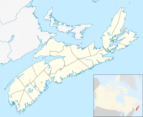
 Location of Waterville in Nova Scotia | |
| Coordinates: 45°3′N 64°40′W / 45.050°N 64.667°W | |
| Country | |
| Province | |
| County | Kings |
| Elevation | 28 m (92 ft) |
Waterville is a Canadian community in Kings County, Nova Scotia. It is administratively part of the village of Cornwallis Square.
Located on the Cornwallis River, the community is located 15 kilometres west of Kentville and is home to a Michelin tire factory, as well as the Nova Scotia Youth Centre.
As of 2021, the population was 703.
Climate
| Climate data for Waterville | |||||||||||||
|---|---|---|---|---|---|---|---|---|---|---|---|---|---|
| Month | Jan | Feb | Mar | Apr | May | Jun | Jul | Aug | Sep | Oct | Nov | Dec | Year |
| Record high °C (°F) | 18 (64) |
17.5 (63.5) |
24.5 (76.1) |
27.5 (81.5) |
33.5 (92.3) |
34 (93) |
34.5 (94.1) |
36 (97) |
33.5 (92.3) |
27 (81) |
23 (73) |
18.5 (65.3) |
36 (97) |
| Mean daily maximum °C (°F) | −1.2 (29.8) |
−0.2 (31.6) |
3.7 (38.7) |
9.9 (49.8) |
17.0 (62.6) |
22.2 (72.0) |
25.6 (78.1) |
25.1 (77.2) |
20.5 (68.9) |
13.9 (57.0) |
7.8 (46.0) |
2 (36) |
12.2 (54.0) |
| Mean daily minimum °C (°F) | −10.1 (13.8) |
−9.5 (14.9) |
−5.4 (22.3) |
0.3 (32.5) |
5.3 (41.5) |
10.1 (50.2) |
13.6 (56.5) |
13.1 (55.6) |
9.2 (48.6) |
4.1 (39.4) |
0.1 (32.2) |
−5.9 (21.4) |
2.1 (35.8) |
| Record low °C (°F) | −31 (−24) |
−35.5 (−31.9) |
−26 (−15) |
−14.5 (5.9) |
−5.5 (22.1) |
−0.5 (31.1) |
3.5 (38.3) |
1 (34) |
−4 (25) |
−8 (18) |
−17 (1) |
−26.5 (−15.7) |
−35.5 (−31.9) |
| Average precipitation mm (inches) | 111.7 (4.40) |
86.6 (3.41) |
103.8 (4.09) |
92.7 (3.65) |
98 (3.9) |
76.6 (3.02) |
77.6 (3.06) |
75.2 (2.96) |
102 (4.0) |
109.3 (4.30) |
119.1 (4.69) |
114.2 (4.50) |
1,166 (45.9) |
| Source: Environment Canada[1] | |||||||||||||
Demographics
In the 2021 Census of Population conducted by Statistics Canada, Waterville had a population of 703 living in 314 of its 327 total private dwellings, a change of -5.9% from its 2016 population of 747. With a land area of 1.79 km2 (0.69 sq mi), it had a population density of 392.7/km2 (1,017.2/sq mi) in 2021.[2]
References
- ↑ Environment Canada Canadian Climate Normals 1981–2010, accessed 15 January 2018
- ↑ "Population and dwelling counts: Canada and designated places". Statistics Canada. 9 February 2022. Retrieved 9 May 2022.
45°3′10.26″N 64°40′28.15″W / 45.0528500°N 64.6744861°W
This article is issued from Wikipedia. The text is licensed under Creative Commons - Attribution - Sharealike. Additional terms may apply for the media files.