Wea Township | |
|---|---|
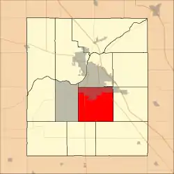 Location in Tippecanoe County | |
| Coordinates: 40°20′34″N 86°52′02″W / 40.34278°N 86.86722°W | |
| Country | United States |
| State | Indiana |
| County | Tippecanoe |
| Government | |
| • Type | Indiana township |
| Area | |
| • Total | 36.06 sq mi (93.4 km2) |
| • Land | 36.04 sq mi (93.3 km2) |
| • Water | 0.02 sq mi (0.05 km2) 0.06% |
| Elevation | 633 ft (193 m) |
| Population (2010) | |
| • Total | 31,660 |
| • Density | 878.5/sq mi (339.2/km2) |
| Time zone | UTC-5 (Eastern (EST)) |
| • Summer (DST) | UTC-4 (EDT) |
| ZIP codes | 47905, 47909 |
| Area code | 765 |
| GNIS feature ID | 454043 |
Wea Township is one of thirteen townships in Tippecanoe County, Indiana, United States. As of the 2010 census, its population was 31,660 and it contained 13,022 housing units.[2]
Geography
According to the 2010 census, the township has a total area of 36.06 square miles (93.4 km2), of which 36.04 square miles (93.3 km2) (or 99.94%) is land and 0.02 square miles (0.052 km2) (or 0.06%) is water.[2]
Cities, towns, villages
- Lafayette (south quarter)
Unincorporated communities
- North Crane at 40°20′19″N 86°48′37″W / 40.3386471°N 86.8102849°W
- South Raub at 40°18′05″N 86°54′48″W / 40.3014256°N 86.9133411°W
(This list is based on USGS data and may include former settlements.)
Adjacent townships
- Fairfield Township (north)
- Perry Township (northeast)
- Sheffield Township (east)
- Lauramie Township (southeast)
- Randolph Township (southwest)
- Union Township (west)
Cemeteries
The township contains these cemeteries: Conarroe, Fink, Kenny, Meadow View, O'Neall, Provault, Shoemaker, Sickler, Spring Grove and Wildcat.
Major highways
School districts
- Lafayette School Corporation
- Tippecanoe School Corporation
Political districts
- Indiana's 4th congressional district
- State House District 26
- State House District 27
- State House District 41
- State Senate District 22
References
- United States Census Bureau 2007 TIGER/Line Shapefiles
- United States Board on Geographic Names (GNIS)
- United States National Atlas
- ↑ "US Board on Geographic Names". United States Geological Survey. October 25, 2007. Retrieved May 9, 2017.
- 1 2 "Population, Housing Units, Area, and Density: 2010 - County -- County Subdivision and Place -- 2010 Census Summary File 1". United States Census. Archived from the original on February 12, 2020. Retrieved May 10, 2013.
External links
Municipalities and communities of Tippecanoe County, Indiana, United States | ||
|---|---|---|
| Cities | Map of Indiana highlighting Tippecanoe County | |
| Towns | ||
| Townships | ||
| CDPs | ||
| Other communities | ||
| Ghost towns | ||
| Footnotes | ‡This populated place also has portions in an adjacent county or counties | |
This article is issued from Wikipedia. The text is licensed under Creative Commons - Attribution - Sharealike. Additional terms may apply for the media files.