Wei County
威县 | |
|---|---|
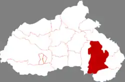 Wei County in Xingtai | |
.png.webp) Xingtai in Hebei | |
| Coordinates: 36°58′51″N 115°16′29″E / 36.9807°N 115.2747°E | |
| Country | People's Republic of China |
| Province | Hebei |
| Prefecture-level city | Xingtai |
| County seat | Mingzhou Town (洺州镇) |
| Area | |
| • Total | 994 km2 (384 sq mi) |
| Elevation | 37 m (121 ft) |
| Population | |
| • Total | 540,000 |
| • Density | 540/km2 (1,400/sq mi) |
| Time zone | UTC+8 (China Standard) |
| Postal code | 054700 |
Wei County or Weixian (simplified Chinese: 威县; traditional Chinese: 威縣; pinyin: Wēi Xiàn) is a county in the south of Hebei province, China. It is under the administration of the prefecture-level city of Xingtai, with a population of 540,000 residing in an area of 994 km2 (384 sq mi). It is served by G45 Daqing–Guangzhou Expressway and China National Highway 106.
Administrative divisions
Wei County consists of 5 towns and 11 townships.[1]
Towns:
- Mingzhou (洺州镇)
- Liyuantun (梨元屯镇)
- Zhangtai (章台镇)
- Houguan (侯贯镇)
- Qiji (七级镇)
Townships:
- Fangjiaying Township (方家营乡)
- Dishiying Township (第什营乡)
- Zaoyuan Township (枣园乡)
- Guxian Township (固献乡)
- Hezhao Township (贺钊乡)
- Heying Township (贺营乡)
- Zhangying Township (张营乡)
- Changtun Township (常屯乡)
- Changzhuang Township (常庄乡)
- Gaogongzhuang Township (高公庄乡)
- Zhaocun Township (赵村乡)
Climate
| Climate data for Weixian (1991–2020 normals, extremes 1981–2010) | |||||||||||||
|---|---|---|---|---|---|---|---|---|---|---|---|---|---|
| Month | Jan | Feb | Mar | Apr | May | Jun | Jul | Aug | Sep | Oct | Nov | Dec | Year |
| Record high °C (°F) | 18.7 (65.7) |
25.3 (77.5) |
30.8 (87.4) |
35.2 (95.4) |
41.1 (106.0) |
41.2 (106.2) |
40.6 (105.1) |
37.9 (100.2) |
38.1 (100.6) |
31.9 (89.4) |
27.3 (81.1) |
23.4 (74.1) |
41.2 (106.2) |
| Mean daily maximum °C (°F) | 3.7 (38.7) |
8.1 (46.6) |
15.1 (59.2) |
22.1 (71.8) |
27.9 (82.2) |
32.3 (90.1) |
32.1 (89.8) |
30.5 (86.9) |
27.1 (80.8) |
21.3 (70.3) |
12.5 (54.5) |
5.4 (41.7) |
19.8 (67.7) |
| Daily mean °C (°F) | −2.3 (27.9) |
1.7 (35.1) |
8.5 (47.3) |
15.5 (59.9) |
21.5 (70.7) |
26.1 (79.0) |
27.2 (81.0) |
25.6 (78.1) |
20.9 (69.6) |
14.5 (58.1) |
6.1 (43.0) |
−0.5 (31.1) |
13.7 (56.7) |
| Mean daily minimum °C (°F) | −7.2 (19.0) |
−3.4 (25.9) |
2.7 (36.9) |
9.4 (48.9) |
15.3 (59.5) |
20.3 (68.5) |
22.9 (73.2) |
21.5 (70.7) |
15.9 (60.6) |
8.7 (47.7) |
0.9 (33.6) |
−5.2 (22.6) |
8.5 (47.3) |
| Record low °C (°F) | −20.5 (−4.9) |
−17.0 (1.4) |
−9.7 (14.5) |
−1.5 (29.3) |
3.8 (38.8) |
8.6 (47.5) |
16.5 (61.7) |
13.0 (55.4) |
4.6 (40.3) |
−4.3 (24.3) |
−14.7 (5.5) |
−21.4 (−6.5) |
−21.4 (−6.5) |
| Average precipitation mm (inches) | 2.9 (0.11) |
7.3 (0.29) |
9.0 (0.35) |
28.1 (1.11) |
41.6 (1.64) |
60.2 (2.37) |
128.4 (5.06) |
114.7 (4.52) |
44.2 (1.74) |
26.9 (1.06) |
15.2 (0.60) |
3.6 (0.14) |
482.1 (18.99) |
| Average precipitation days (≥ 0.1 mm) | 1.8 | 2.9 | 2.8 | 5.2 | 6.3 | 8.1 | 10.7 | 9.7 | 6.9 | 5.4 | 3.9 | 2.2 | 65.9 |
| Average snowy days | 2.3 | 2.7 | 0.9 | 0.2 | 0 | 0 | 0 | 0 | 0 | 0 | 0.9 | 2.1 | 9.1 |
| Average relative humidity (%) | 63 | 58 | 53 | 57 | 59 | 60 | 77 | 82 | 75 | 69 | 69 | 66 | 66 |
| Mean monthly sunshine hours | 150.5 | 158.9 | 209.4 | 227.8 | 250.8 | 216.4 | 181.3 | 180.6 | 181.6 | 177.8 | 148.2 | 145.3 | 2,228.6 |
| Percent possible sunshine | 49 | 52 | 56 | 58 | 57 | 49 | 41 | 43 | 49 | 52 | 49 | 49 | 50 |
| Source: China Meteorological Administration[2][3] | |||||||||||||
References
- ↑ 2011年统计用区划代码和城乡划分代码:威县 (in Chinese). National Bureau of Statistics of the People's Republic of China. Retrieved 2012-07-21.
- ↑ 中国气象数据网 – WeatherBk Data (in Simplified Chinese). China Meteorological Administration. Retrieved 26 August 2023.
- ↑ 中国气象数据网 (in Simplified Chinese). China Meteorological Administration. Retrieved 26 August 2023.
This article is issued from Wikipedia. The text is licensed under Creative Commons - Attribution - Sharealike. Additional terms may apply for the media files.