Wheatfield Township | |
|---|---|
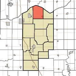 Location in Jasper County | |
| Coordinates: 41°13′35″N 87°06′07″W / 41.22639°N 87.10194°W | |
| Country | United States |
| State | Indiana |
| County | Jasper |
| Government | |
| • Type | Indiana township |
| Area | |
| • Total | 43.47 sq mi (112.6 km2) |
| • Land | 43.36 sq mi (112.3 km2) |
| • Water | 0.11 sq mi (0.3 km2) 0.25% |
| Elevation | 656 ft (200 m) |
| Population (2010) | |
| • Total | 4,395 |
| • Density | 101.4/sq mi (39.2/km2) |
| GNIS feature ID | 0454050 |
Wheatfield Township is one of thirteen townships in Jasper County, Indiana, United States. As of the 2010 census, its population was 4,395 and it contained 1,658 housing units.[1]
Wheatfield Township was established in 1858.[2]
Geography
According to the 2010 census, the township has a total area of 43.47 square miles (112.6 km2), of which 43.36 square miles (112.3 km2) (or 99.75%) is land and 0.11 square miles (0.28 km2) (or 0.25%) is water.[1] The stream of Delehanty Ditch runs through this township.
Cities and towns
Unincorporated towns
Adjacent townships
- Pleasant Township, Porter County (northeast)
- Kankakee Township (east)
- Walker Township (southeast)
- Keener Township (west)
- Boone Township, Porter County (northwest)
Major highways
Education
Wheatfield Township residents are eligible to obtain a free library card from the Jasper County Public Library.[3]
References
- 1 2 "Population, Housing Units, Area, and Density: 2010 - County -- County Subdivision and Place -- 2010 Census Summary File 1". United States Census. Archived from the original on February 12, 2020. Retrieved May 10, 2013.
- ↑ A standard history of Jasper and Newton counties, Indiana. Lewis Publishing Company. 1916. p. 51.
- ↑ "How do I get a library card?". Jasper County Public Library. Retrieved March 8, 2018.
External links
Municipalities and communities of Jasper County, Indiana, United States | ||
|---|---|---|
| City | Map of Indiana highlighting Jasper County | |
| Towns | ||
| Townships | ||
| CDPs | ||
| Other communities | ||
| Footnotes | ‡This populated place also has portions in an adjacent county or counties | |
This article is issued from Wikipedia. The text is licensed under Creative Commons - Attribution - Sharealike. Additional terms may apply for the media files.