| Yurungkash River White Jade River, Baiyu River | |
|---|---|
 Collecting jade in the White Jade River near Khotan in 2011 | |
| Native name | |
| Physical characteristics | |
| Source | Kunlun Mountains |
| • coordinates | 35°31′38″N 81°29′42″E / 35.527297°N 81.495070°E |
| Mouth | Hotan River |
• coordinates | 38°04′53″N 80°33′45″E / 38.081296°N 80.562477°E |
| Basin size | 14,575 km2 (5,627 sq mi) |
| Discharge | |
| • average | 72.3 cubic metres per second (2,550 cu ft/s) |
| Basin features | |
| Progression | Hotan→ Tarim→ Taitema Lake |
| White Jade River | |||||||||||
|---|---|---|---|---|---|---|---|---|---|---|---|
| Uyghur name | |||||||||||
| Uyghur | يورۇڭقاش دەرياسى | ||||||||||
| |||||||||||
| Chinese name | |||||||||||
| Traditional Chinese | 玉龍喀什河 | ||||||||||
| Simplified Chinese | 玉龙喀什河 | ||||||||||
| |||||||||||
| Alternative Chinese name | |||||||||||
| Chinese | 白玉河 | ||||||||||
| |||||||||||
The White Jade River, also known by the native names Baiyu or Yurungkash, is a river in the southern Xinjiang region of China.[1]
The head waters of the river rise in the Kunlun Mountains, in the area of Aksai Chin in Kashmir in the Togatax area (35°36′N 81°24′E / 35.6°N 81.4°E). The river flows east for some 200 km and then north for another 200 km before passing through Khotan, China (37°07′N 79°58′E / 37.11°N 79.97°E).[1] In Khotan, the river has yielded white river rocks which are also known as nephrite jade.[1] [2]
North of Khotan, it eventually dries up in the Taklamakan desert, its seasonal bed joined by that of the Black Jade River (Karakash River) near Koxlax (some 200 km north of Khotan, 38°05′N 80°34′E / 38.08°N 80.56°E), from where it continues north as the Hotan River, which flows into the Tarim River. The river drains an area of 14,575 km2 (5,627 sq mi) and has a discharge of 72.3 cubic metres per second (2,550 cu ft/s).
The river gets its name from the white jade that is often found in its alluvial deposits. The jade can also however be found in semi-shallow areas of the river..
Roads
- China local highway S216 follows the river from Khotan to 36°30′N 79°54′E / 36.5°N 79.9°E.
- Keriyadavan Road from Akqik (some segments under construction) crosses Kunlun mountains and follows the river from 35°54′N 80°36′E / 35.9°N 80.6°E to 35°48′N 80°54′E / 35.8°N 80.9°E.
Gallery
 Yurungkash River near Hotan (2017).
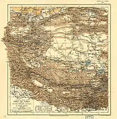
 Map including White Jade River (labelled as Yurungkash R (Khotan)) (RGS, early 20th century)
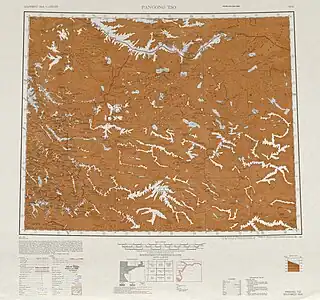
 Map including the northern section of the White Jade River (labeled as Yü-lung-ha-shih Ho) and surrounding region (USATC, 1971)[lower-alpha 1]
 Map including the southern section of the White Jade River (labeled as Yurung Kash) and surrounding region (AMS, 1950)[lower-alpha 2]
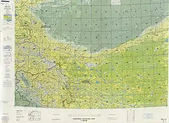
 Map including the White Jade River (labeled as Ywungkax He (Yü-lung-k'o-shih Ho)) and surrounding region) (DMA, 1980)[lower-alpha 3]
See also
Notes
References
- 1 2 3 Jacobs, Andrew (September 20, 2010). "Jade from China's West Surpasses Gold in Value". The New York Times. Retrieved November 16, 2018.
- ↑ Moore, Malcolm (August 8, 2008). "White jade rush in China's Wild West". The Daily Telegraph. Retrieved November 16, 2018.
External links
- Khotan River formed by confluence White Jade and Black Jade Rivers, China (with image)
- Moyu-Hetian Highway (G3012) project ... - also includes construction of Yurungkash River Grand Bridge near Hetian, Xinjiang, China.