| White Loch | |
|---|---|
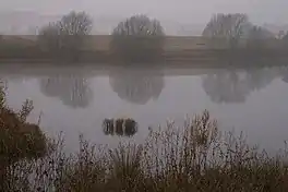
 White Loch Living up to its name on a misty morning, 31 December 2007 | |
 White Loch | |
| Location | NO169429 |
| Coordinates | 56°34′15″N 3°21′09″W / 56.570700°N 3.352500°W |
| Type | freshwater loch |
| Max. length | 0.4828 km (0.3000 mi)[1] |
| Max. width | 0.225 km (0.140 mi)[1] |
| Surface area | 4.9 ha (12 acres)[2] |
| Average depth | 13 ft (4.0 m)[1] |
| Max. depth | 32 ft (9.8 m)[1] |
| Water volume | 8,425,000 cu ft (238,600 m3)[1] |
| Shore length1 | 1.2 km (0.75 mi) [2] |
| Surface elevation | 48 m (157 ft)[2] |
| Max. temperature | 59 °F (15 °C) |
| Min. temperature | 50.2 °F (10.1 °C) |
| Islands | 0 |
| 1 Shore length is not a well-defined measure. | |
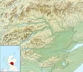
White Loch is a small lowland freshwater loch that is located directly to the east of Fingask Loch in the valley of the Lunan Burn and is 1.5 miles south of Blairgowrie, in Perth and Kinross.[1][2] The loch is also a designated Site of Special Scientific Interest (SSSI), as well as forming part of a Special Area of Conservation.[3]
Geography
White Loch is one of three lochs that sit in a row on an orientation of 280 degrees, with Fingask Loch directly to the west and the tiny, almost pond sized Black Loch sitting directly to the east.[4] White Loch drains into Fingask Loch which in turn drains into small burn that meets the Lunan Burn.[4]
References
- 1 2 3 4 5 6 John, Murray; Lawrence, Pullar. Bathymetrical Survey of the Fresh-Water Lochs of Scotland, 1897-1909 Lochs of the Tay Basin Volume II - Fingask Loch. National Library of Scotland. p. 108. Retrieved 25 March 2019.
 This article incorporates text from this source, which is in the public domain.
 - 1 2 3 4 "White Loch". British Lakes. Retrieved 26 April 2019.
- ↑ Dunkeld - Blairgowrie Lochs, Joint Nature Conservation Committee
- 1 2 John, Murray; Laurence, Pullar (1904). The Scottish Geographical Magazine. Edinburgh: T & A Constable, Edinburgh University Press. p. 16.
This article is issued from Wikipedia. The text is licensed under Creative Commons - Attribution - Sharealike. Additional terms may apply for the media files.