White River | |
|---|---|
| Township of White River | |
 | |
 White River | |
| Coordinates: 48°35′N 85°17′W / 48.583°N 85.283°W | |
| Country | Canada |
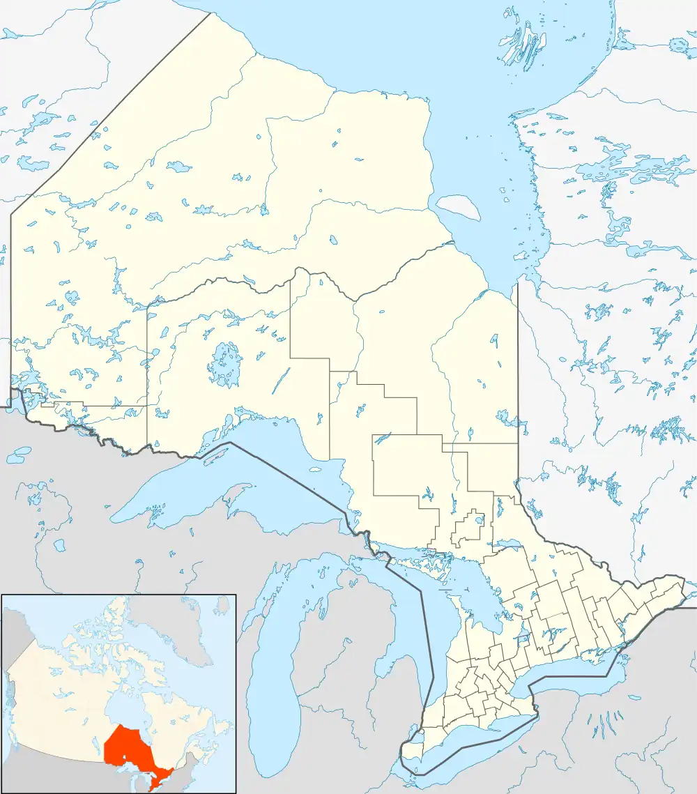
| Province | Ontario |
| District | Algoma |
| Established | 1885 |
| Government | |
| • Type | Township |
| • Mayor | Tara Anderson Hart |
| • Federal riding | Algoma—Manitoulin—Kapuskasing |
| • Prov. riding | Algoma—Manitoulin |
| Area | |
| • Land | 96.78 km2 (37.37 sq mi) |
| Population (2016)[1] | |
| • Total | 645 |
| • Density | 6.7/km2 (17/sq mi) |
| Time zone | UTC-5 (EST) |
| • Summer (DST) | UTC-4 (EDT) |
| Postal Code | P0M |
| Area code | 807 |
| Highways | |
| Website | www |
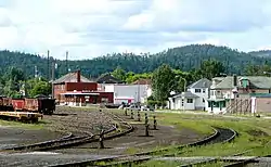
White River is a township located in Northern Ontario, Canada, along Highway 17 of the Trans-Canada Highway. It was originally a rail town on the Canadian Pacific Railway in 1885.
Its main employers are Albert Bazzoni Ltd., A&W Restaurant, Tri Timber, NCCP, CP Rail, Home Hardware, and Primary Power.[2]
History
In the early 1880s, White River started as a workcamp along the Canadian Pacific Railway, then under construction, but grew into a town when this site was selected by William Van Horne as the railway's divisional point. By 1886, it had a station house, fine hotels and an ice house. A stockyard to feed and water the livestock that regularly traveled through was also added. Its population grew from 10 families in 1886 to 42 families in 1906.[3]
In 1961, Highway 17 reached White River, making it accessible by car. This brought new industries and businesses, particularly tourism-related, to the town, ending its existence as an exclusive railway town.[3] In the 1970s, Abitibi-Price established a lumber mill, which was purchased by Domtar Forest Products in 1984 and closed in July 2007.[4] In 2013, the Domtar assets were purchased by the Township of White River and the Netmizaaggamig Nishnaabeg (Pic Mobert First Nation) along with private partners. The mill was then reopened, with significant investment in new equipment, as White River Forest Products LP.[5]
Geography
White River is located north of Lake Superior, on the namesake White River and halfway along Highway 17 between Marathon and Wawa. This is also roughly halfway between Toronto and Winnipeg.[2]
Climate

White River advertises itself as "The Coldest Spot in Canada" with recorded temperatures as low as −58 °C (−72 °F). However, this is a myth, as the coldest temperature in Canada was recorded in Snag, Yukon, at −62.8 °C (−81.0 °F) on 3 February 1947.[6] Even in Ontario, the coldest recorded temperature was in Iroquois Falls on 23 January 1935 [−58.3 °C (−72.9 °F)], which is also the lowest temperature ever recorded in Eastern Canada.[6] White River's reputation for being the "coldest spot" is probably based on the fact that for many years, its reported temperature was deemed "the coldest in the nation today" from the handful of stations reporting daily temperature extremes in newspapers and on radio, with most stations' data being available only on a monthly basis to Environment Canada at the time.
Its official weather station (which closed in 1976) was located in a frost hollow, but most residential areas have good air drainage and do not see temperatures far below −40 °C (−40 °F). Gardeners can keep their flowers alive into October and grow non-boreal species such as silver maple.
Demographics
In the 2021 Census of Population conducted by Statistics Canada, White River had a population of 557 living in 270 of its 333 total private dwellings, a change of -13.6% from its 2016 population of 645. With a land area of 95.55 km2 (36.89 sq mi), it had a population density of 5.8/km2 (15.1/sq mi) in 2021.[7]
| 2016 | 2011 | |
|---|---|---|
| Population | 645 (+6.3% from 2011) | 607 (-27.8% from 2006) |
| Land area | 96.78 km2 (37.37 sq mi) | 96.94 km2 (37.43 sq mi) |
| Population density | 6.3/km2 (16/sq mi) | 6.3/km2 (16/sq mi) |
| Median age | 48.0 (M: 48.8, F: 47.3) | 46.9 (M: 46.8, F: 47.1) |
| Private dwellings | 411 (total) | 435 (total) |
| Median household income | $74,752 | $58,732 |
|
| |||||||||||||||||||||||||||||||||
| Source: Statistics Canada[12][13] | ||||||||||||||||||||||||||||||||||
Mother tongue:[14]
- English as first language: 78%
- French as first language: 16%
- English and French as first language: 1%
- Other as first language: 5%
Tourism

The township is perhaps best known for being the home of Winnie the Pooh. In August 1914, a trapped black bear cub was sold to Captain Harry Colebourn in White River, and Colebourn named it Winnipeg, or Winnie, after his hometown of Winnipeg, Manitoba. Over the years, the animal became the basis for the popular literary character. The town celebrates "Winnie's Hometown Festival" every third week in August.[3]
Being surrounded by wilderness, White River has a lot of outdoor recreation opportunities. Summer activities include hiking, biking, fishing, hunting, boating and canoeing. In the winter the town offers cross-country skiing and snowmobiling.[2]
Other attractions include:[15]
- Heritage Museum - documents the history of White River and includes Canadian Pacific Railway artifacts, rare Winnie the Pooh artifacts, displays White River in the early 1900s, as well as some artwork by the Group of Seven.
- Authentic Canadian Pacific Railway caboose
- Picnic Lake - with an unsupervised sandy beach, picnic tables, and boat launch.
- Tukanee Lake - nature area with rocks, water, and trails.
Transportation
White River is located at the intersection of Highway 17 and Highway 631, which connects the town to Highway 11 to the north.
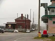
White River station is the western terminus of Via Rail's thrice-weekly Sudbury–White River train, which operates east to Greater Sudbury. Greyhound Canada stopped serving White River on 31 October 2018, when it ended all service west of Sudbury. Ontario Northland buses continue to serve White River.[16]
In popular culture
White River is referenced by the Canadian singer/songwriter Christine Fellows in her song "Migrations".
See also
References
- 1 2 "Census Profile, 2016 Census: White River, Township". Statistics Canada. Retrieved 9 June 2019.
- 1 2 3 "About". www.whiteriverlibrary.com. White River Public Library. Retrieved 25 October 2021.
- 1 2 3 "History". www.whiteriverlibrary.com. White River Public Library. Retrieved 25 October 2021.
- ↑ "2017-2021 Strategic Plan" (PDF). www.whiteriver.ca. The Corporation of the Township of White River. 2016. Retrieved 25 October 2021.
- ↑ "White River Forest Products Ltd. Fact Sheet" (PDF). Pic Mobert First Nation. Retrieved 13 November 2018.
- 1 2 David Phillips. "Cold Places in Canada". Historca The Canadian Encyclopedia. Archived from the original on 13 November 2006. Retrieved 20 June 2008.
- ↑ "Population and dwelling counts: Canada, provinces and territories, census divisions and census subdivisions (municipalities), Ontario". Statistics Canada. 9 February 2022. Retrieved 2 April 2022.
- ↑ "2016 Community Profiles". 2016 Canadian Census. Statistics Canada. 12 August 2021. Retrieved 9 June 2019.
- ↑ "2011 Community Profiles". 2011 Canadian Census. Statistics Canada. 21 March 2019. Retrieved 17 February 2012.
- ↑ "2006 Community Profiles". 2006 Canadian Census. Statistics Canada. 20 August 2019.
- ↑ "2001 Community Profiles". 2001 Canadian Census. Statistics Canada. 18 July 2021.
- ↑ 1996, 2001, 2006 census
- ↑ "White River census profile". 2011 Census of Population. Statistics Canada. Archived from the original on 4 March 2016. Retrieved 17 February 2012.
- ↑ "White River, Ontario - 2006", Community Profiles, Statistics Canada, retrieved 31 January 2016
- ↑ "Things to Do". www.whiteriver.ca. The Corporation of the Township of White River. Retrieved 25 October 2021.
- ↑ Walters, Jeff (26 September 2018). "Going without Greyhound: Travellers to end up stranded with loss of connections". CBC. Retrieved 1 February 2019.
External links
Places adjacent to White River, Ontario | |
|---|---|
