Whitewater Township | |
|---|---|
 Snow Hill Covered Bridge | |
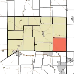 Location of Whitewater Township in Franklin County | |
| Coordinates: 39°20′55″N 84°52′18″W / 39.34861°N 84.87167°W | |
| Country | United States |
| State | Indiana |
| County | Franklin |
| Government | |
| • Type | Indiana township |
| Area | |
| • Total | 35.21 sq mi (91.2 km2) |
| • Land | 34.98 sq mi (90.6 km2) |
| • Water | 0.23 sq mi (0.6 km2) |
| Elevation | 889 ft (271 m) |
| Population (2010) | |
| • Total | 2,684 |
| • Density | 76.7/sq mi (29.6/km2) |
| FIPS code | 18-84068[2] |
| GNIS feature ID | 454057 |
Whitewater Township is one of thirteen townships in Franklin County, Indiana. As of the 2010 census, its population was 2,684.[3]
History
Whitewater Township was created in 1816.[4]
The Snow Hill Covered Bridge and Salmon Turrell Farmstead are listed on the National Register of Historic Places.[5]
Geography
According to the 2010 census, the township has a total area of 35.21 square miles (91.2 km2), of which 34.98 square miles (90.6 km2) (or 99.35%) is land and 0.23 square miles (0.60 km2) (or 0.65%) is water.[3]
Unincorporated towns
- Ashby (extinct)
- Drewersburg
- New Trenton
- Rockdale
- Sharptown
(This list is based on USGS data and may include former settlements.)
Major highways
Cemeteries
The township contains two cemeteries: Otwell and Snow.
References
- ↑ "US Board on Geographic Names". United States Geological Survey. October 25, 2007. Retrieved January 31, 2008.
- ↑ "U.S. Census website". United States Census Bureau. Retrieved January 31, 2008.
- 1 2 "Population, Housing Units, Area, and Density: 2010 - County -- County Subdivision and Place -- 2010 Census Summary File 1". United States Census. Archived from the original on February 12, 2020. Retrieved May 10, 2013.
- ↑ Reifel, August Jacob (1915). History of Franklin County, Indiana. Windmill Publications. pp. 127.
- ↑ "National Register Information System". National Register of Historic Places. National Park Service. July 9, 2010.
External links
Places adjacent to Whitewater Township, Franklin County, Indiana | |
|---|---|
Municipalities and communities of Franklin County, Indiana, United States | ||
|---|---|---|
| City | Map of Indiana highlighting Franklin County | |
| Towns | ||
| Townships | ||
| CDPs | ||
| Other communities |
| |
| Footnotes | ‡This populated place also has portions in an adjacent county or counties | |
This article is issued from Wikipedia. The text is licensed under Creative Commons - Attribution - Sharealike. Additional terms may apply for the media files.