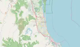
| Willow Vale Gold Coast City, Queensland | |||||||||||||||
|---|---|---|---|---|---|---|---|---|---|---|---|---|---|---|---|
 Hotham Creek Road | |||||||||||||||
 Willow Vale | |||||||||||||||
| Coordinates | 27°50′34″S 153°15′53″E / 27.8427°S 153.2647°E | ||||||||||||||
| Population | 2,096 (2016 census)[1] | ||||||||||||||
| • Density | 97.49/km2 (252.5/sq mi) | ||||||||||||||
| Postcode(s) | 4209 | ||||||||||||||
| Area | 21.5 km2 (8.3 sq mi) | ||||||||||||||
| Time zone | AEST (UTC+10:00) | ||||||||||||||
| LGA(s) | City of Gold Coast | ||||||||||||||
| State electorate(s) | Coomera | ||||||||||||||
| Federal division(s) | Forde | ||||||||||||||
| |||||||||||||||
Willow Vale is a rural locality in the City of Gold Coast, Queensland, Australia.[2] In the 2016 census, Willow Vale had a population of 2,096 people.[1]
Before the naming of this locality, the area was generally referred to as Pimpama.
History
In the 2016 census, Willow Vale had a population of 2,096 people.[1]
Heritage listings
Heritage listings at Willow Vale include:
- 105 Ruffles Road: Laurel Hill Farmhouse[3] [4]
Education
There are no schools in Willow Vale. The nearest government primary schools are Pimpama State School in neighbouring Pimpama to the north, Coomera Spring State School in neighbouring Upper Coomera to the east, and Upper Coomera State College in neighbouring Upper Coomera to the south-east. The nearest government secondary schools are Pimpama State Secondary College in Pimpama to the north-east and Upper Coomera State College in neighbouring Upper Coomera to the south-east.[5]
Amenities
There are a number of parks in the area:
- Blacks Road Parklands 1 (27°50′18″S 153°15′16″E / 27.8384°S 153.2544°E)[6]
- Blacks Road Parklands 2 (27°50′23″S 153°15′16″E / 27.8398°S 153.2545°E)[6]
- Coulter Road Reserve (27°50′41″S 153°17′04″E / 27.8448°S 153.2845°E)[6]
- Crystal Creek Reserve (27°51′04″S 153°15′50″E / 27.8510°S 153.2638°E)[6]
- Galt Road Park (27°51′33″S 153°15′44″E / 27.8592°S 153.2621°E)[6]
- Gerrale Dr Reserve 1 (27°49′55″S 153°15′05″E / 27.8319°S 153.2513°E)[6]
- Gerrale Dr Reserve 2 (27°50′00″S 153°14′54″E / 27.8334°S 153.2484°E)[6]
- Gerrale Dr Reserve 3 (27°50′08″S 153°14′47″E / 27.8355°S 153.2465°E)[6]
- Heritage Park (27°49′49″S 153°17′19″E / 27.8302°S 153.2887°E)[6]
- Hotham Ruffles Reserve (27°52′06″S 153°16′20″E / 27.8683°S 153.2721°E)[6]
- Lower Galt Road Reserve (27°51′23″S 153°16′12″E / 27.8563°S 153.2700°E)[6]
- Peanba Park (27°51′20″S 153°16′47″E / 27.8556°S 153.2796°E)[6]
- Pittas Place Reserve (27°50′55″S 153°15′43″E / 27.8486°S 153.2619°E)[6]
- Richardson Family Park (27°50′20″S 153°15′17″E / 27.8389°S 153.2548°E)[6]
- Ruffles Rd Reserve (27°50′53″S 153°16′38″E / 27.8480°S 153.2772°E)[6]
- Rufous Whistler Park (27°49′24″S 153°16′49″E / 27.8233°S 153.2802°E)[6]
- The Dell Park (27°50′39″S 153°14′56″E / 27.8443°S 153.2488°E)[6]
- The Grange Common (27°50′29″S 153°15′05″E / 27.8415°S 153.2513°E)[6]
- The Grange Environmental Park (27°50′28″S 153°14′16″E / 27.8412°S 153.2377°E)[6]
- Willowvale Reserve (27°51′47″S 153°16′27″E / 27.8630°S 153.2742°E)[6]
- Wongawallan Reserve (27°52′07″S 153°15′22″E / 27.8687°S 153.2560°E)[6]
References
- 1 2 3 Australian Bureau of Statistics (27 June 2017). "Willow Vale (SSC)". 2016 Census QuickStats. Retrieved 20 October 2018.
- ↑ "Willow Vale – locality in City of Gold Coast (entry 46095)". Queensland Place Names. Queensland Government. Retrieved 7 March 2022.
- ↑ "Laurel Hill Farmhouse (entry 601936)". Queensland Heritage Register. Queensland Heritage Council. Retrieved 19 June 2013.
- ↑ Gold Coast Local Heritage Register - A to M, pp. 67-68
- ↑ "Queensland Globe". State of Queensland. Retrieved 13 March 2022.
- 1 2 3 4 5 6 7 8 9 10 11 12 13 14 15 16 17 18 19 20 21 "Land for public recreation - Queensland". Queensland Open Data. Queensland Government. 20 November 2020. Archived from the original on 22 November 2020. Retrieved 22 November 2020.
Sources
- "Gold Coast Local Heritage Register - A to M" (PDF). Gold Coast City Council. Retrieved 26 August 2020.
External links
- "Gold Coast Inner Hinterland". Queensland Places. Centre for the Government of Queensland, University of Queensland. — includes Willow Vale