Wilton Township | |
|---|---|
Township | |
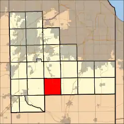 Location in Will County | |
| Country | United States |
| State | Illinois |
| County | Will |
| Established | November 6, 1849 |
| Area | |
| • Total | 36.34 sq mi (94.1 km2) |
| • Land | 36.34 sq mi (94.1 km2) |
| • Water | 0 sq mi (0 km2) 0% |
| Elevation | 300 ft (90 m) |
| Population (2010) | |
| • Estimate (2016)[1] | 828 |
| • Density | 23.1/sq mi (8.9/km2) |
| Time zone | UTC-6 (CST) |
| • Summer (DST) | UTC-5 (CDT) |
| FIPS code | 17-197-82244 |
| Website | www.wiltontownship.org/ |
Wilton Township is located in Will County, Illinois. As of the 2010 census, its population was 841 and it contained 318 housing units.[2]
Geography
According to the 2010 census, the township has a total area of 36.34 square miles (94.1 km2), all land.[2] The Unincorporated communities of Wallingford, Wilton, and Wilton Center are located in the township. The former settlement of Pierce was also located in Wilton Township. Major roads are Wilmington-Peotone Rd, U.S. Route 52, Elevator Rd, Tulley Rd, and Cedar Rd.
Demographics
| Census | Pop. | Note | %± |
|---|---|---|---|
| 2016 (est.) | 828 | [1] | |
| U.S. Decennial Census[3] | |||
School
Wilton Township does not have its own school district. It is a part of Peotone Community School District 207 - U.
References
- 1 2 "Population and Housing Unit Estimates". Retrieved June 9, 2017.
- 1 2 "Population, Housing Units, Area, and Density: 2010 - County -- County Subdivision and Place -- 2010 Census Summary File 1". United States Census. Archived from the original on February 12, 2020. Retrieved May 28, 2013.
- ↑ "Census of Population and Housing". Census.gov. Retrieved June 4, 2016.
External links
Municipalities and communities of Will County, Illinois, United States | ||
|---|---|---|
| Cities | Map of Illinois highlighting Will County | |
| Villages |
| |
| Townships | ||
| CDPs | ||
| Other communities | ||
| Ghost town | ||
| Footnotes | ‡This populated place also has portions in an adjacent county or counties | |
41°20′17″N 87°57′39″W / 41.33806°N 87.96083°W
This article is issued from Wikipedia. The text is licensed under Creative Commons - Attribution - Sharealike. Additional terms may apply for the media files.