| Wuling National Forest Recreation Area Chinese: 武陵國家森林遊樂區 | |
|---|---|
 | |
| Map | |
_location_map.svg.png.webp) | |
| Geography | |
| Location | Heping, Taichung, Taiwan |
| Coordinates | 24°24′13.4″N 121°18′14.3″E / 24.403722°N 121.303972°E |
| Elevation | 1,800-3,884 m |
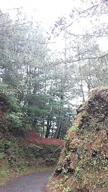
Taoshan Trail
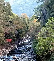
Cijiawan River, the native habitat of the Formosan landlocked salmon
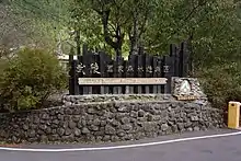
Wuling National Forest Recreation Area (traditional Chinese: 武陵國家森林遊樂區; simplified Chinese: 武陵国家森林游乐区; pinyin: Wǔlíng Guójiā Sēnlín Yóulè Qū) is located in Heping District, Taichung, Taiwan.
Geology
The forest recreation area spans over an area at the elevation of 1,800-3,884 meters above sea level with annual mean temperature of 16°C. It features the Taoshan Waterfall at the end of the Taoshan Trail.[1]
Transportation
The recreation area is accessible by bus from Taichung Station of Taiwan Railways.[2]
See also
References
- ↑ "Wuling Forest Recreation Areas". Taiwan Forest Recreation. Retrieved 12 February 2018.
- ↑ "Wuling National Forest Recreation Area". Taiwan, the Heart of Asia. Retrieved 12 February 2018.
This article is issued from Wikipedia. The text is licensed under Creative Commons - Attribution - Sharealike. Additional terms may apply for the media files.