| Wurm | |
|---|---|
 Zwei Mühlen on the Wurm between Schloss Rimburg (D) and the village of Rimburg (NL) | |
 Course of the Inde, Wurm and Rur | |
| Location | |
| Country | Germany |
| State | North Rhine-Westphalia |
| Reference no. | DE: 2828 |
| Physical characteristics | |
| Source | |
| • location | South of Aachen |
| • coordinates | 50°44′15″N 6°05′16″E / 50.7374694°N 6.0877111°E |
| • elevation | 265 m above sea level (NN) |
| Mouth | |
• location | North of Heinsberg into the Rur |
• coordinates | 51°05′52″N 6°06′22″E / 51.0977°N 6.1062°E |
• elevation | 32 m above sea level (NN) |
| Length | 57.1 km (35.5 mi) [1] |
| Basin size | 355.518 km2 (137.266 sq mi) [1] |
| Basin features | |
| Progression | Rur→ Meuse→ North Sea |
| Landmarks |
|
The Wurm (German pronunciation: [vʊʁm]; Dutch: Worm [ʋɔr(ə)m]) is a river in the state of North Rhine-Westphalia in western Germany. It rises in the Eifel mountains and flows for 57 kilometres before discharging into the Rur.
Geography
The Wurm is a left (western) tributary of the Rur (Dutch: Roer). The Rur is a tributary of the Meuse.
The sources of the Wurm are several brooks in the forests southwest of Aachen, which form the Wurm after the Diepenbenden reservoir. From there the Wurm nowadays flows through canals through the city of Aachen, until it resurfaces again at the Europaplatz in the east of Aachen. North of Aachen (between Kerkrade and Herzogenrath) the river forms the border with the Netherlands for approximately 10 km. It flows into the Rur near Heinsberg.
Other towns on the river Wurm are Würselen, Übach-Palenberg and Geilenkirchen.
The name Wurm is thought to originate from the German word warm (same meaning in English), as the source brooks were fed from the thermal springs in Aachen.
Gallery
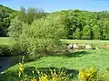 Meanders of the Wurm near Kohlscheid
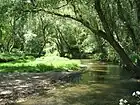 Wilderness
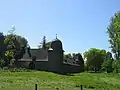 Rimburg Castle near Übach-Palenberg
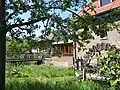 Watermill near Zweibrüggen
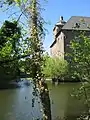 Castle Trips, Geilenkirchen
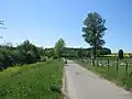 Wurm valley near Süggerath
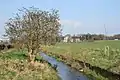 Wurm at Gut Kalkofen, Aachen
See also
- Rur Basin
- List of rivers of North Rhine-Westphalia
 Media related to Wurm at Wikimedia Commons
References
- Kalinka, G.; Schütten, J. (1993). Naturraum Wurmtal. Wurmverlag Herzogenrath. ASIN B0029ZWV8I.