Altai
Алтай ᠠᠯᠲᠠᠢ | |
|---|---|
| Yesönbulag District Есөнбулаг сум ᠶ᠋ᠢᠰᠦᠨᠪᠤᠯᠠᠭᠰᠤᠮᠤ | |
 | |
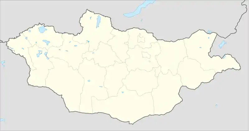 Altai Location in Mongolia | |
| Coordinates: 46°22′22″N 96°15′26″E / 46.37278°N 96.25722°E | |
| Country | |
| Province (aimag) | Govi-Altai |
| District (sum) | Yesönbulag |
| Area | |
| • Total | 2,161 km2 (834 sq mi) |
| Elevation | 2,213 m (7,260 ft) |
| Population (2017) | |
| • Total | 17,617 |
| • Density | 8.2/km2 (21/sq mi) |
| Area code | +976 (0) 148 |
| Vehicle registration | ГА |
| Climate | BSk |
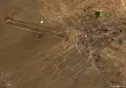
Altai City (Mongolian: Алтай хот, romanized: Altai hot, pronounced [aɬˈtʰæˑ χɔʰt]) is the capital of the Govi-Altai province in western Mongolia. As of 2008, its population is 15,800.[1]
Transportation
The Altai Airport (LTI/ZMAT) has one runway and is served by regular flights to Arvaikheer and Ulaanbaatar.
Climate
Altai City has a typical Mongolian cold semi-arid climate (Köppen BSk) with subarctic (Dwc) influences, although the climate is so dry as to qualify as a cold desert climate (Köppen BWk) despite the annual mean being sufficient for sporadic permafrost. The climate experiences long, very dry and very cold winters with short, mild summers when the majority of the scant precipitation occurs.
| Climate data for Altai (1991-2020, extremes 1954-present) | |||||||||||||
|---|---|---|---|---|---|---|---|---|---|---|---|---|---|
| Month | Jan | Feb | Mar | Apr | May | Jun | Jul | Aug | Sep | Oct | Nov | Dec | Year |
| Record high °C (°F) | 5.0 (41.0) |
9.0 (48.2) |
13.1 (55.6) |
23.4 (74.1) |
28.9 (84.0) |
31.6 (88.9) |
31.1 (88.0) |
32.0 (89.6) |
28.9 (84.0) |
19.0 (66.2) |
11.9 (53.4) |
10.6 (51.1) |
32.0 (89.6) |
| Mean daily maximum °C (°F) | −10.5 (13.1) |
−7.1 (19.2) |
−0.8 (30.6) |
7.7 (45.9) |
13.9 (57.0) |
19.7 (67.5) |
21.5 (70.7) |
19.8 (67.6) |
13.6 (56.5) |
5.5 (41.9) |
−2.8 (27.0) |
−8.6 (16.5) |
6.0 (42.8) |
| Daily mean °C (°F) | −18.0 (−0.4) |
−14.6 (5.7) |
−7.6 (18.3) |
1.3 (34.3) |
7.6 (45.7) |
13.6 (56.5) |
15.8 (60.4) |
13.8 (56.8) |
7.4 (45.3) |
−0.7 (30.7) |
−9.2 (15.4) |
−15.4 (4.3) |
−0.5 (31.1) |
| Mean daily minimum °C (°F) | −24.3 (−11.7) |
−21.3 (−6.3) |
−14.4 (6.1) |
−5.1 (22.8) |
1.2 (34.2) |
7.2 (45.0) |
9.9 (49.8) |
7.8 (46.0) |
1.4 (34.5) |
−6.5 (20.3) |
−15.3 (4.5) |
−21.6 (−6.9) |
−6.7 (19.9) |
| Record low °C (°F) | −40 (−40) |
−39.8 (−39.6) |
−35.9 (−32.6) |
−30.6 (−23.1) |
−16.4 (2.5) |
−6.9 (19.6) |
−0.4 (31.3) |
−4.4 (24.1) |
−17.2 (1.0) |
−28.9 (−20.0) |
−35 (−31) |
−38.4 (−37.1) |
−40.0 (−40.0) |
| Average precipitation mm (inches) | 1 (0.0) |
5 (0.2) |
3 (0.1) |
8 (0.3) |
24 (0.9) |
31 (1.2) |
40 (1.6) |
31 (1.2) |
12 (0.5) |
7 (0.3) |
3 (0.1) |
2 (0.1) |
167 (6.5) |
| Average precipitation days (≥ 1.0 mm) | 1.4 | 1.5 | 2.1 | 2.4 | 3.7 | 5.7 | 7.0 | 5.7 | 3.5 | 2.6 | 1.9 | 1.6 | 39.1 |
| Average relative humidity (%) | 71.7 | 67.1 | 59.7 | 51.4 | 49.1 | 52.9 | 58.6 | 59.0 | 55.8 | 61.4 | 68.7 | 71.4 | 60.6 |
| Mean monthly sunshine hours | 201.1 | 208.3 | 252.2 | 260.6 | 308.9 | 298.5 | 293.2 | 290.2 | 272.4 | 246.1 | 199.6 | 184.8 | 3,015.9 |
| Source 1: Pogoda.ru.net [2] | |||||||||||||
| Source 2: NOAA (sun 1961-1990) [3] [4] | |||||||||||||
References
Wikivoyage has a travel guide for Altai_(Mongolia).
- ↑ Annual Report 2008 Archived 2011-07-22 at the Wayback Machine. Govi-Altai Statistical Office.
- ↑ КЛИМАТ УЛАН-БАТОРА (in Russian). Pogoda.ru.net. Retrieved 4 January 2015.
- ↑ "Altai Climate Normals 1973-1990". National Oceanic and Atmospheric Administration. Retrieved January 13, 2013.
- ↑ "Altai Climate Normals 1991-2020". National Oceanic and Atmospheric Administration. Retrieved August 11, 2023.
This article is issued from Wikipedia. The text is licensed under Creative Commons - Attribution - Sharealike. Additional terms may apply for the media files.