Yŏnsan County
연산군 | |
|---|---|
| Korean transcription(s) | |
| • Hanja | 延山郡 |
| • McCune-Reischauer | Yŏnsan-gun |
| • Revised Romanization | Yeonsan-gun |
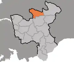 Map of North Hwanghae showing the location of Yonsan | |
| Country | North Korea |
| Province | North Hwanghae Province |
| Area | |
| • Total | 547.5 km2 (211.4 sq mi) |
| Population (2008[1]) | |
| • Total | 66,568 |
| • Density | 120/km2 (310/sq mi) |
Yŏnsan County is a county in North Hwanghae province, North Korea.
Administrative divisions
Yŏnsan county is divided into 1 ŭp (town), 1 rodongjagu (workers' district) and 14 ri (villages):
|
|
Infrastructure
Yonsan has a hydropower station with two generator units. The first unit commenced operation on 9 September 2008.[2]
Transportation
Yonsan County has a trolleybus line in Holdong-rodongjagu; it is observed to run west to a tunnel entrance from next to a building in Holdong-rodongjagu. The state of operation is unknown and no trolleybuses can be observed from satellite imagery.[3]
Historic sites
The tomb complex of Kongp'o-ri[4]
References
- ↑ North Korea: Administrative Division
- ↑ Korean Central Television (2021-09-14). [록화보도] 9월14일 20시보도 (in Korean).
- ↑ "북한지역정보넷". www.cybernk.net. Retrieved 2021-01-02.
- ↑ "황해북도 연산군 공포리 무덤떼 발굴 간략보고". 동북아역사넷.

This article is issued from Wikipedia. The text is licensed under Creative Commons - Attribution - Sharealike. Additional terms may apply for the media files.