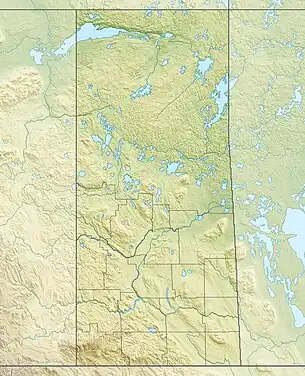
| York Lake | |
|---|---|
 York Lake Location in Saskatchewan  York Lake York Lake (Canada) | |
| Location | RM of Orkney No. 244, |
| Coordinates | 51°09′21″N 102°28′43″W / 51.1558°N 102.4785°W |
| Primary inflows | Willow Brook |
| Catchment area | Yorkton Creek |
| Basin countries | |
| Surface area | 316 ha (780 acres) |
| Max. depth | 4.3 m (14 ft) |
| Shore length1 | 20.5 km (12.7 mi) |
| Surface elevation | 511 m (1,677 ft) |
| 1 Shore length is not a well-defined measure. | |
York Lake,[1] formally known as Pebble Lake, is a lake in the south-east region of the Canadian province of Saskatchewan. It is a shallow, narrow lake located about 5 kilometres (3.1 mi) south of the city of Yorkton in the Prairie Pothole Region of North America, which extends throughout three Canadian provinces and five U.S. states, and within Palliser's Triangle and the Great Plains ecoregion of Canada.
The primary inflow for York Lake is from Willow Brook,[2] which begins in the RM of Garry No. 245 in the Beaver Hills.[3] Willow Brook travels in an easterly direction from the hills into Rousay Lake, which is connected to York Lake at its northern end.[4] At the southern end of York Lake, the lake's outflow leaves the lake and heads in a north-east to Yorkton Creek, south of Yorkton.[5][6]
York Lake Golf & Country Club is at the northern end of the lake and Yorkton Lake Regional Park and Maple Gove Estates are on the eastern shore.[7]
York Lake Regional Park
Since the turn of the 20th century, the lake has been used for recreational purposes by the settlers of the region. The original park on the lake was sponsored by the city of Yorkton and the local Kinsman Club. In 1969, it became a regional park of Saskatchewan.[8]
York Lake Regional Park (51°09′55″N 102°29′20″W / 51.1652°N 102.4889°W) has a campground, beach access, a golf course, baseball diamonds, trap and skeet shooting, 3D archery, indoor gun range, playground, concession, a nature trail, and Yorkton Navy League. The campground has 31 electrified daily campsites as well as 32 seasonal sites.[9] The hiking trail is a self-guided trail that runs along the eastern shore of the lake and is about 3 kilometres (1.9 mi) long.[10]
The golf course, originally known as Yorkton Country Club, was established in 1926. In 1943, it became known as South Wood Golf Club and in 1964, the current name, York Lake Golf & Country Club, was established. It was originally an 18-hole, sand green course, but due to multiple floods beginning in 2010, the back-nine became unplayable. In 2019, three of the nine flooded holes were restored creating a 12-hole golf course. The golf course, located at the northern end of York Lake, is about five kilometres north of the entrance gate to York Lake Regional Park.[11]
See also
References
- ↑ "York Lake". Canadian Geographical Names Database. Government of Canada. Retrieved 31 May 2022.
- ↑ "Willow Brook". Canadian Geographical Names Database. Government of Canada. Retrieved 31 May 2022.
- ↑ "Beaver Hills". Canadian Geographical Names Database. Government of Canada. Retrieved 31 May 2022.
- ↑ "York Lake Fishing Map". GPS Nautical Charts. Bist LLC. Retrieved 31 May 2022.
- ↑ "York Lake". Geoview.info. Geoview.info. Retrieved 31 May 2022.
- ↑ "York Lake". Backroad Mapbooks (BRMB). Mussio Ventures Ltd. Retrieved 31 May 2022.
- ↑ "Maple Grove Estates". Maple Grove Estates. Maple Grove Estates. Retrieved 31 May 2022.
- ↑ "York Lake". Regional Parks of Saskatchewan. Government of Saskatchewan. Retrieved 31 May 2022.
- ↑ "York Lake Regional Park". Tourism Saskatchewan. Government of Saskatchewan. Retrieved 31 May 2022.
- ↑ "York Lake Regional Park Nature Trail". All Trails. AllTrails, LLC. Retrieved 31 May 2022.
- ↑ "York Lake Golf & Country Club". York Lake Golf. York Lake Golf and Country Club. Retrieved 31 May 2022.