Yoyogikamizonochō
代々木神園町 | |
|---|---|
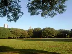
 Yoyogi Park | |
| Coordinates: 35°40′29″N 139°41′36″E / 35.674703°N 139.693383°E | |
| Country | |
| Prefecture | |
| Special ward | |
| Population (住民基本台帳・外国人登録による人口)[1] | |
| • Total | 118 |
| Time zone | UTC+09:00 |
| ZIP code | 151-0052 |
| Telephone area code | 03 |
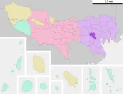
Yoyogikamizonochō (代々木神園町) is a district of Shibuya, Tokyo, Japan.
As of October 2020, the population of this district is 118.[1] The postal code for Yoyogikamizonochō is 151-0052.
Geography
Yoyogikamizonochō borders Yoyogi in the north and west, Sendagaya to the east, and Jinnan to the south.
Education
Shibuya Board of Education operates public elementary and junior high schools.
Yoyogikamizonochō 1 is zoned to Sendagaya Elementary School (千駄谷小学校). Yoyogikamizonochō 2 is zoned to Jinnan Elementary School (神南小学校). Yoyogikamizonochō 3-4 is zoned to Yoyogi Sanya Elementary School (代々木山谷小学校).[2]
Yoyogikamizonochō 1 is zoned to Harajuku Gaien Junior High School (原宿外苑中学校). Yoyogikamizonochō 2 is zoned to Shoto Junior High School (松濤中学校). Yoyogikamizonochō 3-4 is zoned to Yoyogi Junior High School (代々木中学校).[3]
References
- 1 2 "住民基本台帳・外国人登録による人口". 渋谷区. Shibuya City. Retrieved 18 October 2020.
- ↑ "学校別通学区域(小学校)". City of Shibuya. Retrieved 2022-10-08. - Has elementary zoning
- ↑ "学校別通学区域(中学校)". City of Shibuya. Retrieved 2022-10-08. - Has junior high school zoning
