Zámoly | |
|---|---|
 Flag  Coat of arms | |
 Zámoly Location of Zámoly | |
| Coordinates: 47°19′04″N 18°24′27″E / 47.31770°N 18.40763°E | |
| Country | |
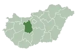
| County | Fejér |
| Area | |
| • Total | 48.5 km2 (18.7 sq mi) |
| Population (2004) | |
| • Total | 2,216 |
| • Density | 45.69/km2 (118.3/sq mi) |
| Time zone | UTC+1 (CET) |
| • Summer (DST) | UTC+2 (CEST) |
| Postal code | 8081 |
| Area code | 22 |
| Website | www |
Zámoly is a village in Fejér county, Hungary.
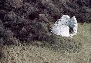
Zámoly, ruins from above
External links
 Media related to Zámoly at Wikimedia Commons
- Street map (in Hungarian)
| Cities with county rights |
|   |
|---|---|---|
| Towns | ||
| Large villages | ||
| Villages |
| |
| Other topics |
| |
This article is issued from Wikipedia. The text is licensed under Creative Commons - Attribution - Sharealike. Additional terms may apply for the media files.