Zadní Chodov | |
|---|---|
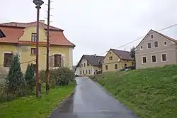 Houses in Zadní Chodov | |
 Flag  Coat of arms | |
 Zadní Chodov Location in the Czech Republic | |
| Coordinates: 49°53′26″N 12°39′17″E / 49.89056°N 12.65472°E | |
| Country | |
| Region | Plzeň |
| District | Tachov |
| First mentioned | 1365 |
| Area | |
| • Total | 13.88 km2 (5.36 sq mi) |
| Elevation | 517 m (1,696 ft) |
| Population (2023-01-01)[1] | |
| • Total | 241 |
| • Density | 17/km2 (45/sq mi) |
| Time zone | UTC+1 (CET) |
| • Summer (DST) | UTC+2 (CEST) |
| Postal code | 348 15 |
| Website | www |
Zadní Chodov (German: Hinter Kotten) is a municipality and village in Tachov District in the Plzeň Region of the Czech Republic. It has about 200 inhabitants.
Zadní Chodov lies approximately 11 kilometres (7 mi) north of Tachov, 56 km (35 mi) west of Plzeň, and 130 km (81 mi) west of Prague.
Administrative parts
The village of Kyjov is an administrative part of Zadní Chodov.
References
Wikimedia Commons has media related to Zadní Chodov.
This article is issued from Wikipedia. The text is licensed under Creative Commons - Attribution - Sharealike. Additional terms may apply for the media files.