Zell an der Pram | |
|---|---|
 | |
|
Flag  Coat of arms | |
 Zell an der Pram Location within Austria | |
| Coordinates: 48°19′00″N 13°38′00″E / 48.31667°N 13.63333°E | |
| Country | Austria |
| State | Upper Austria |
| District | Schärding |
| Government | |
| • Mayor | Matthias Bauer (ÖVP) |
| Area | |
| • Total | 23.37 km2 (9.02 sq mi) |
| Elevation | 367 m (1,204 ft) |
| Population (2018-01-01)[2] | |
| • Total | 2,021 |
| • Density | 86/km2 (220/sq mi) |
| Time zone | UTC+1 (CET) |
| • Summer (DST) | UTC+2 (CEST) |
| Postal code | 4755 |
| Area code | 07764 |
| Vehicle registration | SD |
| Website | www.zell-pram.ooe.gv.at |
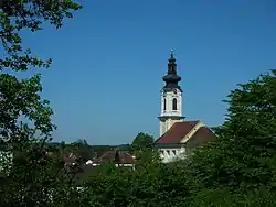
Zell an der Pram is a town and a municipality in the district of Schärding in the Austrian state of Upper Austria.
Geography
Zell lies in the Innviertel. About 14 percent of the municipality is forest, and 76 percent is farmland.
The municipality includes the following populated places (Ortschaften)[3]
|
|
|
|
References
- ↑ "Dauersiedlungsraum der Gemeinden Politischen Bezirke und Bundesländer - Gebietsstand 1.1.2018". Statistics Austria. Retrieved 10 March 2019.
- ↑ "Einwohnerzahl 1.1.2018 nach Gemeinden mit Status, Gebietsstand 1.1.2018". Statistics Austria. Retrieved 9 March 2019.
- ↑ "Bevölkerung am 1.1.2018 nach Ortschaften (Gebietsstand 1.1.2018)" (in German). Bundesanstalt Statistik Österreich.
Wikimedia Commons has media related to Zell an der Pram.
This article is issued from Wikipedia. The text is licensed under Creative Commons - Attribution - Sharealike. Additional terms may apply for the media files.