Zemendorf-Stöttera | |
|---|---|
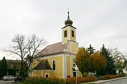 Catholic church in Zemendorf | |
 Coat of arms | |
 Zemendorf-Stöttera Location within Austria | |
| Coordinates: 47°46′N 16°27′E / 47.767°N 16.450°E | |
| Country | Austria |
| State | Burgenland |
| District | Mattersburg |
| Government | |
| • Mayor | Josef Haider |
| Area | |
| • Total | 12.83 km2 (4.95 sq mi) |
| Elevation | 198 m (650 ft) |
| Population (2018-01-01)[2] | |
| • Total | 1,268 |
| • Density | 99/km2 (260/sq mi) |
| Time zone | UTC+1 (CET) |
| • Summer (DST) | UTC+2 (CEST) |
| Postal code | 7023 |
| Website | www.zemendorf-stoettera.at |
Zemendorf-Stöttera (Hungarian: Zemenye-Selegd; Croatian: Cemendrof-Štetr (Štedra, Stodra)) is a town in the district of Mattersburg in the Austrian state of Burgenland.
Geography
It consists of two parts, Zemendorf and Stöttera, both of which lie on the River Wulka downstream from Pöttelsdorf and upstream from Antau.
History
Until 1926, Stöttera was called Stöttern.
Population
| Year | Pop. | ±% |
|---|---|---|
| 1869 | 1,562 | — |
| 1880 | 1,674 | +7.2% |
| 1890 | 1,800 | +7.5% |
| 1900 | 1,745 | −3.1% |
| 1910 | 1,654 | −5.2% |
| 1923 | 1,562 | −5.6% |
| 1934 | 1,541 | −1.3% |
| 1939 | 1,489 | −3.4% |
| 1951 | 1,402 | −5.8% |
| 1961 | 1,315 | −6.2% |
| 1971 | 1,321 | +0.5% |
| 1981 | 1,282 | −3.0% |
| 1991 | 1,223 | −4.6% |
| 2001 | 1,272 | +4.0% |
| 2011 | 1,297 | +2.0% |
References
- ↑ "Dauersiedlungsraum der Gemeinden Politischen Bezirke und Bundesländer - Gebietsstand 1.1.2018". Statistics Austria. Retrieved 10 March 2019.
- ↑ "Einwohnerzahl 1.1.2018 nach Gemeinden mit Status, Gebietsstand 1.1.2018". Statistics Austria. Retrieved 9 March 2019.
This article is issued from Wikipedia. The text is licensed under Creative Commons - Attribution - Sharealike. Additional terms may apply for the media files.