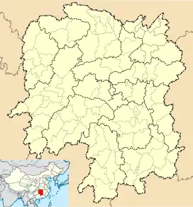
Zhabu Hui Ethnic Township
鲊埠回族乡 | |
|---|---|
 Zhabu Hui Ethnic Township Location in Hunan | |
| Coordinates: 28°33′44″N 111°49′06″E / 28.56222°N 111.81833°E | |
| Country | People's Republic of China |
| Province | Hunan |
| Prefecture-level city | Yiyang |
| County | Taojiang |
| Area | |
| • Total | 48 km2 (19 sq mi) |
| Population | 18,970 |
| Time zone | UTC+8 (China Standard) |
| Area code | 0737 |
Zhabu Hui Ethnic Township (simplified Chinese: 鲊埠回族乡; traditional Chinese: 鮓埠回族鄉; pinyin: zhǎbù huízú xiāng) is a rural ethnic township in Taojiang County, Hunan Province, People's Republic of China.[1][2]
Administrative division
The township is divided into 9 villages and 1 community, the following areas: Zhabu Community, Chemenduan Village, Huayuantai Village, Jungongzui Village, Dashuitian Village, Jiangjiaba Village, Nanjingwan Village, Yanxi Village, Taogongmiao Village, and Zhujilun Village (鲊埠社区、车门塅村、花园台村、军功嘴村、大水田村、江家坝村、南京湾村、颜溪村、陶公庙村、筑基仑村).
References
External links
This article is issued from Wikipedia. The text is licensed under Creative Commons - Attribution - Sharealike. Additional terms may apply for the media files.