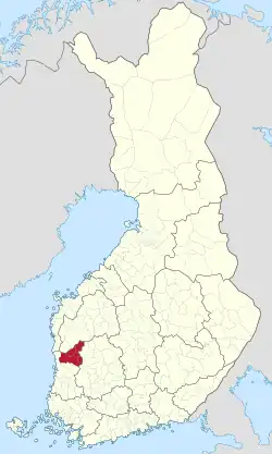
北薩塔昆塔次區
北薩塔昆塔次區(芬蘭語:;瑞典語:),簡稱北薩塔昆塔(芬蘭語:;瑞典語:),是芬蘭薩塔昆塔區的一個次區,在歐盟一級地方行政單位統計區(LAU 1,即舊的 NUTS 4)中的代碼為044[6],在GeoNames中的代碼則為9610680[1]。其人口共18399人[3];面積2273.41平方公里(其中陸地面積2200.83平方公里,水域面積72.58平方公里)[2]。
| 北薩塔昆塔次區 Pohjois-Satakunnan seutukunta | |
|---|---|
| 次區 | |
 | |
| 坐标: 61.87030°N 22.34786°E[1] | |
| 國家 | |
| 行政區 | 薩塔昆塔區 |
| 面积[2] | |
| • 总计 | 2,273.41 平方公里(877.77 平方英里) |
| • 陸地 | 2,200.83 平方公里(849.75 平方英里) |
| • 水域 | 72.58 平方公里(28.02 平方英里) |
| 人口(2020)[3] | |
| • 總計 | 18,399人 |
| • 密度 | 8.09人/平方公里(21人/平方英里) |
| 时区 | EET[4](UTC+2) |
| • 夏时制 | EEST[5](UTC+3) |
| GeoNames[1] | 9610680 |
| LAU 1(NUTS 4)[6] | 044 |
人口變化
參考資料
- |. GeoNames. [2020-07-14] (英语).
- . Maanmittauslaitos. 2020-01-01 [2020-07-13]. (原始内容存档于2020-07-10) (芬兰语).
- . Tilastokeskus. 2020-01-31 [2020-07-13]. (原始内容存档于2020-12-14) (芬兰语).
- . Time and Date. [2020-07-16]. (原始内容存档于2020-08-04) (英语).
- . Time and Date. [2020-07-16]. (原始内容存档于2020-08-04) (英语).
- . Statistikcentralen. [2013-12-25]. (原始内容存档于2013-11-11) (瑞典语).
- . www.patio.fi. [2020-07-20]. (原始内容存档于2012-10-22) (芬兰语).
- . Tilastokeskus. [2018-01-18]. (原始内容存档于2018-06-17) (芬兰语).
This article is issued from Wikipedia. The text is licensed under Creative Commons - Attribution - Sharealike. Additional terms may apply for the media files.