大草原城 (加拿大)
大草原城(英語:),加拿大艾伯塔省西北部城市,距离埃德蒙顿西北456公里。总人口55,032(2011年),是艾伯塔省第7大城市。
| 大草原城 | |
|---|---|
| 城市 | |
| City of Grande Prairie | |
 从第100大道看第100大街 | |
| 綽號:天鹅城(Swan City)[1] | |
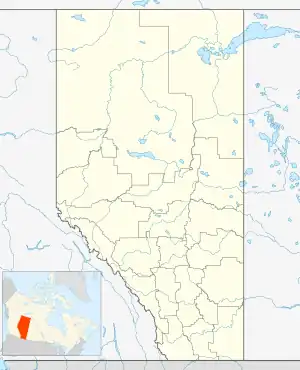 大草原城 所在位置 | |
| 坐标:55°10′N 118°48′W | |
| 国家 | 加拿大 |
| 省 | 艾伯塔省 |
| 地区 | 北艾伯塔 |
| 人口普查分区 | 艾伯塔省第19分区 |
| 建置 [2] - 村 | 1914年4月30日 |
| -镇 | 1919年3月15日 |
| - 市 | 1958年1月1日 |
| 面积 (2011)[3] | |
| • 城市 | 72.80 平方公里(28.11 平方英里) |
| 海拔[4] | 650 公尺(2,130 英尺) |
| 人口(2011) | |
| • 城市 | 55,032人 |
| • 密度 | 755.9人/平方公里(1,958人/平方英里) |
| • 市区 | 54,913 |
| 时区 | 北美山地时间(UTC−7) |
| • 夏时制 | 北美山地夏令时间(UTC−6) |
气候
| 大草原城气候数据(大草原城机场) WMO ID:71940;地理位置55°10′47″N 118°53′06″W;海拔高度669米(2,195英尺),1981-2010年平均数据,1922年至今极端数据 | |||||||||||||
|---|---|---|---|---|---|---|---|---|---|---|---|---|---|
| 月份 | 1月 | 2月 | 3月 | 4月 | 5月 | 6月 | 7月 | 8月 | 9月 | 10月 | 11月 | 12月 | 全年 |
| 历史最高湿热指数 | 14.5 | 11.1 | 15.6 | 28.6 | 30.8 | 33.6 | 40.8 | 36.6 | 34.7 | 27.1 | 17.2 | 12.1 | 40.8 |
| 历史最高温 °C(°F) | 15.2 (59.4) |
12.8 (55.0) |
16.1 (61.0) |
29.4 (84.9) |
34.4 (93.9) |
41.5 (106.7) |
35.6 (96.1) |
34.5 (94.1) |
31.9 (89.4) |
28.9 (84.0) |
22.2 (72.0) |
13.3 (55.9) |
41.5 (106.7) |
| 平均高温 °C(°F) | −8.0 (17.6) |
−4.8 (23.4) |
0.6 (33.1) |
10.1 (50.2) |
16.8 (62.2) |
20.5 (68.9) |
22.6 (72.7) |
21.7 (71.1) |
16.6 (61.9) |
9.4 (48.9) |
−1.8 (28.8) |
−6.0 (21.2) |
8.1 (46.6) |
| 日均气温 °C(°F) | −13.6 (7.5) |
−10.6 (12.9) |
−4.9 (23.2) |
4.1 (39.4) |
10.2 (50.4) |
14.3 (57.7) |
16.2 (61.2) |
15.1 (59.2) |
10.2 (50.4) |
3.6 (38.5) |
−6.6 (20.1) |
−11.3 (11.7) |
2.2 (36.0) |
| 平均低温 °C(°F) | −19.0 (−2.2) |
−16.4 (2.5) |
−10.3 (13.5) |
−2.0 (28.4) |
3.6 (38.5) |
8.1 (46.6) |
9.8 (49.6) |
8.3 (46.9) |
3.8 (38.8) |
−2.1 (28.2) |
−11.4 (11.5) |
−16.7 (1.9) |
−3.7 (25.3) |
| 历史最低温 °C(°F) | −52.2 (−62.0) |
−50.0 (−58.0) |
−42.8 (−45.0) |
−35.6 (−32.1) |
−8.7 (16.3) |
−3.3 (26.1) |
−1.1 (30.0) |
−2.8 (27.0) |
−11.7 (10.9) |
−31.7 (−25.1) |
−40.6 (−41.1) |
−47.2 (−53.0) |
−52.2 (−62.0) |
| 历史最低風寒指數 | −63.0 | −55.0 | −53.1 | −46.7 | −16.1 | −4.3 | 0.0 | −3.2 | −15.3 | −33.9 | −56.1 | −56.3 | −63.0 |
| 平均降水量 mm() | 29.9 (1.18) |
16.4 (0.65) |
16.9 (0.67) |
19.8 (0.78) |
41.0 (1.61) |
75.9 (2.99) |
76.1 (3.00) |
55.8 (2.20) |
43.0 (1.69) |
26.0 (1.02) |
25.4 (1.00) |
18.9 (0.74) |
445.1 (17.52) |
| 平均降雨量 mm() | 2.4 (0.09) |
0.8 (0.03) |
1.4 (0.06) |
10.4 (0.41) |
38.1 (1.50) |
75.9 (2.99) |
76.1 (3.00) |
55.7 (2.19) |
41.3 (1.63) |
15.4 (0.61) |
4.2 (0.17) |
0.7 (0.03) |
322.4 (12.69) |
| 平均降雪量 cm() | 35.0 (13.8) |
20.8 (8.2) |
20.3 (8.0) |
11.0 (4.3) |
3.4 (1.3) |
0.0 (0.0) |
0.0 (0.0) |
0.1 (0.0) |
1.7 (0.7) |
12.0 (4.7) |
26.5 (10.4) |
23.6 (9.3) |
154.3 (60.7) |
| 平均降水天数(≥ 0.2 mm) | 11.7 | 8.5 | 9.0 | 7.6 | 10.5 | 13.2 | 13.3 | 11.8 | 11.7 | 10.7 | 11.3 | 9.1 | 128.4 |
| 平均降雨天数(≥ 0.2 mm) | 1.9 | 0.81 | 1.6 | 4.8 | 10.0 | 13.2 | 13.4 | 11.8 | 11.5 | 7.7 | 2.8 | 0.81 | 80.4 |
| 平均降雪天数(≥ 0.2 cm) | 10.8 | 8.4 | 8.0 | 3.8 | 1.1 | 0.0 | 0.0 | 0.04 | 0.63 | 4.0 | 9.3 | 8.5 | 54.5 |
| 月均日照時數 | 77.8 | 106.2 | 172.1 | 231.0 | 276.0 | 295.2 | 307.7 | 272.4 | 172.5 | 134.5 | 78.9 | 73.5 | 2,197.7 |
| 可照百分比 | 32.1 | 39.1 | 47.0 | 54.6 | 55.1 | 56.9 | 59.1 | 58.7 | 45.0 | 41.3 | 31.2 | 32.7 | 46.1 |
| 来源:Environment and Climate Change Canada[5][6][7] | |||||||||||||
人口统计
| 年份 | 人口 | ±% |
|---|---|---|
| 1916 | 337 | — |
| 1921 | 1,061 | +214.8% |
| 1926 | 917 | −13.6% |
| 1931 | 1,464 | +59.7% |
| 1936 | 1,478 | +1.0% |
| 1941 | 1,724 | +16.6% |
| 1946 | 2,267 | +31.5% |
| 1951 | 2,664 | +17.5% |
| 1956 | 6,302 | +136.6% |
| 1961 | 8,352 | +32.5% |
| 1966 | 11,417 | +36.7% |
| 1971 | 13,079 | +14.6% |
| 1976 | 17,626 | +34.8% |
| 1981 | 24,263 | +37.7% |
| 1986 | 26,471 | +9.1% |
| 1991 | 28,271 | +6.8% |
| 1996 | 31,140 | +10.1% |
| 2001 | 36,983 | +18.8% |
| 2006 | 47,076 | +27.3% |
| 2011 | 55,032 | +16.9% |
| 2016 | 63,166 | +14.8% |
| Source: 加拿大统计局 [8][9][10][11][12][13][14][15][16][17][18] [19][20][21][22][23][24][25][26][27][28] | ||
经济

大草原城和城北农田的鸟瞰图
参考文献
- . City of Grande Prairie. [2012-06-09]. (原始内容存档于2012-04-28).
- Alberta Municipal Affairs. . 2010-09-17 [2010-10-02]. (原始内容存档于2012-03-15).
- . Statistics Canada. 2013-01-30 [2013-03-17]. (原始内容存档于2013-02-07).
- (PDF) (PDF). Safety Codes Council: 212–215 (PDF pages 226–229). January 2012 [October 8, 2013]. (原始内容 (PDF)存档于2013-10-16).
- . Canadian Climate Normals 1981−2010. Environment and Climate Change Canada. October 31, 2011 [May 14, 2014].
- . Canadian Climate Data. Environment and Climate Change Canada. October 31, 2011 [June 3, 2017].
- . Canadian Climate Data. Environment and Climate Change Canada. October 31, 2011 [June 3, 2017].
- . . Population and Agriculture. Ottawa: Government of Canada. 1918: 77–140.
- . . Ottawa: Government of Canada. 1922: 169–215.
- . . Census of Alberta, 1926. Ottawa: Government of Canada. 1927: 565–567.
- . . Ottawa: Government of Canada. 1932: 98–102.
- . . I: Population and Agriculture. Ottawa: Dominion Bureau of Statistics. 1938: 833–836.
- . . II: Population by Local Subdivisions. Ottawa: Dominion Bureau of Statistics. 1944: 134–141.
- . . I: Population. Ottawa: Dominion Bureau of Statistics. 1949: 401–414.
- . . I: Population, General Characteristics. Ottawa: Dominion Bureau of Statistics. 1953: 6.73–6.83.
- . . Population, Counties and Subdivisions. Ottawa: Dominion Bureau of Statistics. 1957: 6.50–6.53.
- . . Series 1.1: Historical, 1901–1961. I: Population. Ottawa: Dominion Bureau of Statistics. 1963: 6.77-6.83.
- . . Population, Specified Age Groups and Sex for Counties and Census Subdivisions, 1966. Ottawa: Dominion Bureau of Statistics. 1968: 6.50–6.53.
- . . I: Population, Census Subdivisions (Historical). Ottawa: Statistics Canada. 1973: 2.102-2.111.
- . . Census Divisions and Subdivisions, Western Provinces and the Territories. I: Population, Geographic Distributions. Ottawa: Statistics Canada. 1977: 3.40–3.43.
- . . II: Provincial series, Population, Geographic distributions (Alberta). Ottawa: Statistics Canada. 1982: 4.1–4.10. ISBN 0-660-51095-2.
- . . Population and Dwelling Counts – Provinces and Territories (Alberta). Ottawa: Statistics Canada. 1987: 2.1–2.10. ISBN 0-660-53463-0.
- . . Population and Dwelling Counts – Census Divisions and Census Subdivisions. Ottawa: Statistics Canada. 1992: 100–108. ISBN 0-660-57115-3.
- . . A National Overview – Population and Dwelling Counts. Ottawa: Statistics Canada. 1997: 136–146. ISBN 0-660-59283-5.
- . Statistics Canada. [2012-04-01]. (原始内容存档于2013-08-21).
- . Statistics Canada. 2010-01-06 [2012-04-01]. (原始内容存档于2016-06-24).
外部链接
This article is issued from Wikipedia. The text is licensed under Creative Commons - Attribution - Sharealike. Additional terms may apply for the media files.