季克西
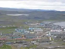
季克西(俄語:,羅馬化:Tiksi;雅庫特語:,羅馬化:Tiksii)為俄罗斯遠東聯邦管區萨哈共和国布倫區境內的一座市級鎮,也是布倫區的行政中心[1],位在拉普捷夫海布奧爾-哈亞灣岸上、勒拿河三角洲東南方。2010年人口普查中該市級鎮人口有5,063人[2]。
| 季克西 Тикси | |
|---|---|
| 市級鎮 | |
 季克西 | |
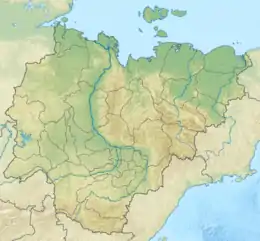
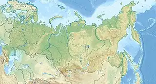
 季克西 季克西在萨哈共和国的位置  季克西 季克西 (俄罗斯) | |
| 坐标: 71°39′N 128°52′E | |
| 國家 | |
| 聯邦管區 | 遠東聯邦管區 |
| 聯邦主體 | |
| 區 | |
| 設立 | 1933年 |
| 成為市級鎮 | 1939年[1] |
| 人口(2010年)[2] | |
| • 總計 | 5,063人 |
| • 估计(2016年)[3] | 4,556 |
| 时区 | 雅库茨克时间(UTC+9) |
| 郵區編號 | 678400 |
| 車輛號牌 | 14 |
| 電話區號 | +7 41167 |
| OKATO | 98212551000 |
| OKTMO | 98612151051 |
歷史
1901年8月,俄羅斯極地船「扎里亞」為了尋找傳說中的桑尼科夫島而率領越過拉普捷夫海,但不久之後即被位於新西伯利亞群島的浮冰所阻隔。1902年,當「扎里亞」被困在岸冰中時,遠征隊員仍繼續嘗試到達桑尼科夫島。1902年11月,俄羅斯北極探險家愛德華·托爾男爵及三名遠征隊員離船後從本尼特島的鬆散浮冰上朝南方探險,但之後一去不回。「扎里亞」最終停靠在季克西灣布魯斯涅夫島附近。其他遠征隊員在船長費多爾·馬蒂森前往雅库茨克時返回圣彼得堡。
現今的季克西設立於1933年,1939年成為市級鎮[1]。冷战期間,季克西境內的北季克西機場和西季克西機場可見軍事建設工程。苏联解体以後,季克西的人口數顯著下降,許多公寓大樓皆陸續荒廢。儘管該地區的人口數下跌,但最北方的聚居地人口仍然超過五千人。
行政與自治地位
在行政區劃組織架構中,季克西(地方行政單位為市級鎮[4])為布倫斯基區的行政中心[1]。在行政區劃中,季克西納入在布倫區中,稱季克西鄉(Settlement of Tiksi)[1]。而在自治區劃中,季克西鄉納入在布倫自治區(Bulunsky Municipal District)中,稱季克西城市聚居地(Tiksi Urban Settlement)[5]。
交通
季克西境內的其中一座主要港口可進入至拉普捷夫海。此外該地區境內設有季克西機場,國防部認為該機場基於安全因素,因此在2012年10月關閉該機場並進行改建[6]。由於季克西機場的關閉,能連接季克西的交通運輸僅剩直升機場和冬季道路。俄羅斯總理德米特里·阿纳托利耶维奇·梅德韦杰夫也因為這件事而備受批評。據國防部與薩哈共和國政府於2013年4月達成協議後,此機場在2013年6月重新開放客運飛行。2013年12月,俄羅斯總統宣布將季克西機場及其他位在北極圈外的機場「恢復」營運[7]。
歷年人口數
| 季克西歷年人口數 | ||||||
|---|---|---|---|---|---|---|
| 1959年 | 1970年 | 1979年 | 1989年[8] | 2002年[9] | 2009年[10] | 2010年[2] |
| 4,833 | 8,099 | 9,505 | 11,649 | 5,873 | 5,566 | 5,063 |
| 2012年 | 2013年 | 2014年 | 2015年 | 2016年[3] | ||
| 5,496 | 5,023 | 4,660 | 4,557 | 4,556 | ||
氣候
由於季克西在冬季時與亞北極地區類似,而且會出現連續性和間歇性強降雪,因此在柯本气候分类法中屬於苔原氣候(ET)。此地區夏季非常短,且較內陸地區涼爽(儘管在1991年所測得的歷史最高溫34°C)。該地區之极昼於5月11日至8月3日間發生,由於太陽在這期間整天皆在地平線以上,所以日照時數較長;而极夜於11月19日至1月24日間發生。
| 季克西 | |||||||||||||
|---|---|---|---|---|---|---|---|---|---|---|---|---|---|
| 月份 | 1月 | 2月 | 3月 | 4月 | 5月 | 6月 | 7月 | 8月 | 9月 | 10月 | 11月 | 12月 | 全年 |
| 历史最高温 °C(°F) | −9 (16) |
−5.2 (22.6) |
1.6 (34.9) |
9.6 (49.3) |
23.6 (74.5) |
32.8 (91.0) |
34.3 (93.7) |
29.8 (85.6) |
23.0 (73.4) |
6.1 (43.0) |
−1.2 (29.8) |
−4.9 (23.2) |
34.3 (93.7) |
| 平均高温 °C(°F) | −26.7 (−16.1) |
−26.1 (−15.0) |
−22.1 (−7.8) |
−13.5 (7.7) |
−2.6 (27.3) |
7.2 (45.0) |
12.1 (53.8) |
11.1 (52.0) |
4.2 (39.6) |
−7.9 (17.8) |
−20.1 (−4.2) |
−25.1 (−13.2) |
−9.1 (15.6) |
| 日均气温 °C(°F) | −30.2 (−22.4) |
−29.6 (−21.3) |
−26.3 (−15.3) |
−18.3 (−0.9) |
−6.1 (21.0) |
3.2 (37.8) |
7.6 (45.7) |
7.7 (45.9) |
1.6 (34.9) |
−10.8 (12.6) |
−23.4 (−10.1) |
−28.4 (−19.1) |
−12.8 (9.0) |
| 平均低温 °C(°F) | −33.8 (−28.8) |
−33.3 (−27.9) |
−30.8 (−23.4) |
−23.7 (−10.7) |
−9.7 (14.5) |
0.1 (32.2) |
3.9 (39.0) |
4.5 (40.1) |
−1.2 (29.8) |
−14.3 (6.3) |
−27.1 (−16.8) |
−31.9 (−25.4) |
−16.4 (2.5) |
| 历史最低温 °C(°F) | −48 (−54) |
−50.5 (−58.9) |
−47.2 (−53.0) |
−46.9 (−52.4) |
−32.2 (−26.0) |
−15.8 (3.6) |
−3.9 (25.0) |
−4 (25) |
−18.2 (−0.8) |
−35 (−31) |
−43.9 (−47.0) |
−48.8 (−55.8) |
−50.5 (−58.9) |
| 平均降水量 mm() | 32 (1.3) |
22 (0.9) |
16 (0.6) |
10 (0.4) |
13 (0.5) |
27 (1.1) |
45 (1.8) |
50 (2.0) |
27 (1.1) |
16 (0.6) |
21 (0.8) |
42 (1.7) |
321 (12.6) |
| 平均降雨天数 | 0.0 | 0.0 | 0.0 | 0.0 | 1 | 12 | 20 | 20 | 9 | 0.1 | 0.0 | 0.0 | 62.1 |
| 平均降雪天数 | 23 | 21 | 21 | 19 | 20 | 5 | 0.2 | 0.3 | 10 | 25 | 23 | 23 | 190.5 |
| 月均日照時數 | 0.0 | 40.0 | 176.9 | 276.5 | 199.0 | 238.2 | 246.4 | 132.6 | 86.8 | 52.9 | 4.0 | 0.0 | 1,453.3 |
| 来源1:погода и климат[11] | |||||||||||||
| 来源2:(sunshine only)[12] | |||||||||||||
參考資料
- Registry of the Administrative-Territorial Divisions of the Sakha Republic
- 俄羅斯聯邦國家統計局. [2010 All-Russian Population Census, vol. 1]. Всероссийская перепись населения 2010 года [2010 All-Russia Population Census]. 俄羅斯聯邦國家統計局. 2011 (俄语).
- Sakha Republic (Yakutia) Territorial Branch of the Federal State Statistics Service. Численность населения по районам республики на 1 января 2016 года (页面存档备份,存于) Population of the districts of the republic on January 1, 2016 (俄文)
- According to Article 7 of the Law #77-I, lower-level administrative divisions with the status of a settlement have their administrative centers in an inhabited locality with the status of an urban-type settlement. According to the Registry of the Administrative-Territorial Divisions of the Sakha Republic, Tiksi is the administrative center of the Settlement of Tiksi.
- Law #173-Z #353-III
- . Газета.ru (莫斯科). 2012-10-03 [2012-10-04]. (原始内容存档于2012-10-07) (俄语).
- . [2016-11-11]. (原始内容存档于2016-05-06).
- [All Union Population Census of 1989: Present Population of Union and Autonomous Republics, Autonomous Oblasts and Okrugs, Krais, Oblasts, Districts, Urban Settlements, and Villages Serving as District Administrative Centers]. Всесоюзная перепись населения 1989 года [All-Union Population Census of 1989]. Институт демографии Национального исследовательского университета: Высшая школа экономики [Institute of Demography at the National Research University: Higher School of Economics]. 1989 –Demoscope Weekly (俄语).
- 俄羅斯聯邦國家統計局. [Population of Russia, Its Federal Districts, Federal Subjects, Districts, Urban Localities, Rural Localities—Administrative Centers, and Rural Localities with Population of Over 3,000] (XLS). Всероссийская перепись населения 2002 года [All-Russia Population Census of 2002]. 2004-05-21 (俄语).
- 俄羅斯聯邦國家統計局. [Permanent Population of the Russian Federation by Cities/Towns, Urban-Type Settlements, and Districts as of 1 January 2009]. 俄羅斯聯邦國家統計局 (俄语).
- . [2016-11-11]. (原始内容存档于2013-04-15).
- . [2016-11-11]. (原始内容存档于2016-03-03).
其他來源
- Official website of the Sakha Republic. Registry of the Administrative-Territorial Divisions of the Sakha Republic. Bulunsky District. (俄文)
- Государственное Собрание (Ил Тумэн) Республики Саха (Якутия). Закон №172-З №351-III от 30 ноября 2004 г. «Об установлении границ и о наделении статусом муниципального района муниципальных образований Республики Саха (Якутия)», в ред. Закона №1535-З №597-V от 27 ноября 2015 г. «О внесении изменений в статьи 1 и 2 Закона Республики Саха (Якутия) "Об установлении границ и о наделении статусом муниципального района муниципальных образований Республики Саха (Якутия)"». Вступил в силу со дня официального опубликования. Опубликован: "Якутия", №245, 31 декабря 2004 г. (State Assembly (Il Tumen) of the Sakha (Yakutia) Republic. Law #172-Z No. 351-III of November 30, 2004 On Establishing the Borders and on Granting the Municipal District Status to the Municipal Formations of the Sakha (Yakutia) Republic, as amended by the Law #1535-Z No. 597-V of November 27, 2015 On Amending Articles 1 and 2 of the Law of the Sakha (Yakutia) Republic "On Establishing the Borders and on Granting the Municipal District Status to the Municipal Formations of the Sakha (Yakutia) Republic". Effective as of the day of the official publication.).
- Государственное Собрание (Ил Тумэн) Республики Саха (Якутия). Закон №173-З №353-III от 30 ноября 2004 г. «Об установлении границ и о наделении статусом городского и сельского поселений муниципальных образований Республики Саха (Якутия)», в ред. Закона №1058-З №1007-IV от 25 апреля 2012 г. «О внесении изменений в Закон Республики Саха (Якутия) "Об установлении границ и о наделении статусом городского и сельского поселений муниципальных образований Республики Саха (Якутия)"». Вступил в силу со дня официального опубликования. Опубликован: "Якутия", №245, 31 декабря 2004 г. (State Assembly (Il Tumen) of the Sakha (Yakutia) Republic. Law #173-Z No. 353-III of November 30, 2004 On Establishing the Borders and on Granting the Urban and Rural Settlement Status to the Municipal Formations of the Sakha (Yakutia) Republic, as amended by the Law #1058-Z No. 1007-IV of April 25, 2012 On Amending the Law of the Sakha (Yakutia) Republic "On Establishing the Borders and on Granting the Urban and Rural Settlement Status to the Municipal Formations of the Sakha (Yakutia) Republic". Effective as of the day of the official publication.).