朗伊罗阿环礁
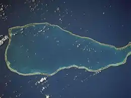
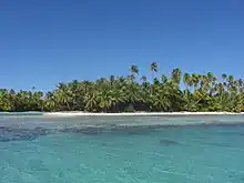
朗伊罗阿环礁(Rangiroa)是南太平洋法屬波利尼西亞的環礁,屬於土阿莫土群島的一部分,由約415個島嶼組成,長80公里、寬5至32公里,土地面積79平方公里,潟湖面積1,446平方公里,最高點海拔高度12米,島上有機場設施,2007年人口2,473。
| 朗伊罗阿环礁 Rangiroa | |
|---|---|
 NASA picture of Rangiroa Atoll | |
 朗伊罗阿环礁 Rangiroa | |
| 地理 | |
| 位置 | Pacific Ocean |
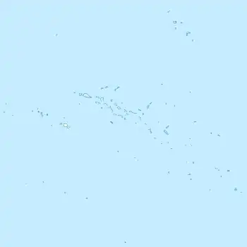
| 坐标 | 15°07′31″S 147°38′43″W |
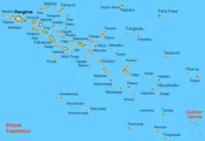
| 群岛 | Tuamotus |
| 总岛屿 | 415 |
| 面積 | 79平方(31平方英里) |
| 长度 | 80千米(50英里) |
| 宽度 | 32千米(19.9英里) |
| 最高海拔 | 12米(39英尺) |
| 最高點 | (unnamed) |
| 管轄 | |
France | |
| Overseas collectivity | French Polynesia |
| Administrative subdivision | Tuamotus |
| Commune | Rangiroa |
| 首府 | Avatoru |
| 最大聚居地 | Tiputa(人口817) |
| 人口统计 | |
| 人口 | 2,567(2012)[1] |
外部連結
- Rangiroa on Oceandots (页面存档备份,存于)
- Island names
- le Maire & Schouten
- Charles Wilkes
- Atoll list (in French)
- Classification of the French Polynesian atolls by Salvat (1985)
- The official site of Tahiti's wine
- . Institut de la statistique de la Polynésie française. [15 October 2014]. (原始内容存档于2020-03-29).
This article is issued from Wikipedia. The text is licensed under Creative Commons - Attribution - Sharealike. Additional terms may apply for the media files.

