钦博拉索山
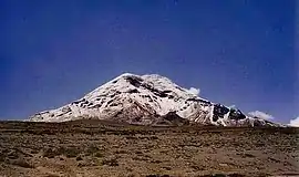
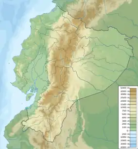
钦博拉索山(奇楚瓦語:Chimpu Rasu,西班牙語:Volcán Chimborazo)位於南美洲的厄瓜多尔,是一座圆锥形的死火山,海拔6268米,位於厄瓜多爾首都基多西南偏南150公里,是厄瓜多尔的最高峰。
| 钦博拉索山 | |
|---|---|
 欽博拉索山 | |
 钦博拉索山 欽博拉索山的位置 | |
| 最高点 | |
| 海拔 | 6,268.2(20,565英尺) [1] |
| 01°28′09″S 78°49′03″W | |
| 地理 | |
| 位置 | |
| 山脈 | 安地斯山脈,厄瓜多尔西部山脉(属于安第斯山脉的一部分) |
| 地形圖 | IGM, CT-ÑIV-C1 |
| 地质 | |
| 岩石年代 | 古近紀 |
| 最近噴發 | 640 CE ± 500 years (Smithsonian n.d., ) |
| 攀山 | |
| 首次登頂 | glacier/snow climb PD |
钦博拉索山是地球固體表面最接近外太空的最高點。[2]近年科學家透过人造卫星测定,地球既不是标准的球形,也不是标准的椭圆球形,而是一个南大、北小、中间鼓的“梨形”。所以,假若测量世界最高峰的基准不是海平面,而是地心的話,位於貼近赤道地区(南緯1度)的钦博拉索山的顶峰才是距离地心最远的一点。因為,钦博拉索山顶峰距地心6384.10千米,而珠穆朗玛峰距地心的距离为6381.95千米,比钦博拉索山少2.15千米。
1802年,德国地理学家亚历山大·冯·洪堡在厄瓜多考察,曾经登到约5600米,由于身体不适而放弃。1880年1月4日,15年前首次登顶马特洪峰的英国人Edward Whymper和当年的竞争对手、意大利人Antoine Carrel及其兄弟Louis Carrel合作,历经艰险,最终登顶。
参考资料
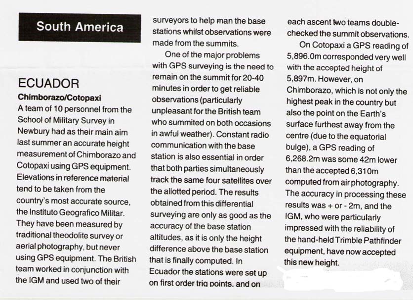
- The elevation given here was established by a differential GPS survey in 1993. The survey was carried out by a team of 10 personnel from the School of Military Survey in Newbury, 聯合王國, working in cooperation with the Ecuadorean Instituto Geografico Militar. Accuracy of ±2 m is claimed. Source: Mountain INFO 136, High Magazine, March 1994 (copy (页面存档备份,存于)). This figure is compatible with SRTM data, unlike an older but still frequently given figure of 6,310(20,702英尺).
- Krulwich, Robert. . NPR. 2007-04-07 [2014-04-23]. (原始内容存档于2007-04-09).
This article is issued from Wikipedia. The text is licensed under Creative Commons - Attribution - Sharealike. Additional terms may apply for the media files.