瑞波鎮
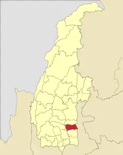
瑞波鎮(緬甸語:,英語:)為緬甸實皆省瑞波縣的鎮區[2]。2014年人口266,807人,區域面積1,057.2平方公里[1]。該鎮坐落在伊洛瓦底河及穆河間的平原上,古代王宮雍笈牙王宮(King Alaungmintaya)則在該鎮被挖掘出[3]。瑞波鎮下分95個村莊。瑞波為瑞波鎮之首府。
| 瑞波鎮 | |
|---|---|
| 瑞波縣鎮區 | |
 瑞波鎮在實皆省的位置 | |
| 坐标:22°34′N 96°42′E | |
| 國家 | |
| 省邦 | 實皆省 |
| 縣 | 瑞波縣 |
| 首府 | 瑞波 |
| 面积 | |
| • 总计 | 1,057.2 平方公里(408.2 平方英里) |
| 人口(2014)[1] | 266,807人 |
| • 密度 | 252.38人/平方公里(653.7人/平方英里) |
| 时区 | MST(UTC+6:30) |
經濟
最近瑞波鎮因灌溉工程技術,使得該鎮的水稻產量大幅提升,現在一年可種三期稻[4]。
外部連結
- "Shwebo Township - Sagaing Division" Map from Myanmar Information Management Unit (MIMU)
- "Shwebo Google Satellite Map" (页面存档备份,存于) Maplandia
參見

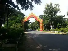
瑞波鎮之歡迎牌
- MYANMAR: Administrative Division (页面存档备份,存于). Citypopulation. 2015-11-18
- "Myanmar States/Divisions & Townships Overview Map" (页面存档备份,存于) Myanmar Information Management Unit (MIMU)
- "Sagaing Division" (页面存档备份,存于) Ministry of Hotels & Tourism, Union of Myanmar
- "Union of Burma - GRAIN Grain and Feed Annual" (页面存档备份,存于) p. 3, GAIN Report Number: BM9008, 29 April 2009, Foreign Agricultural Service, United States Department of Agriculture
This article is issued from Wikipedia. The text is licensed under Creative Commons - Attribution - Sharealike. Additional terms may apply for the media files.