科拉克 (維多利亞州)
科拉克(Colac,/ˈkoʊlæk/)[2]是澳大利亞維多利亞州西區的一個小鎮[3],位於墨爾本西南約150公里處。據2011年人口普查,科拉克有人口11,415人。這裡的主要產業是農業。
| 科拉克 | |
|---|---|
 The Princes Highway running through Colac | |
 科拉克 | |
| 坐标:38°20′0″S 143°35′0″E | |
| 国家 | |
| 一级行政区 | 維多利亞州 |
| 地方政府区域 | Colac Otway Shire |
| 海拔 | 134.0 公尺(439.6 英尺) |
| 人口(2011年普查)[1] | |
| • 總計 | 11,415人 |
| 郵政編碼 | 3250 |
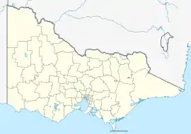
| 位置 |
|
| 州選區 | Polwarth |
| 聯邦選區 | 科藍加 |
參考資料
- Australian Bureau of Statistics. . 2011 Census QuickStats. 31 October 2012 [29 June 2015].
- Butler, S. (编). . 5th. Sydney: Macquarie Dictionary Publishers Pty Ltd. 2009 [2022-07-11]. ISBN 978-18-7642-966-9. (原始内容存档于2019-07-21).
- . The Sydney Morning Herald. 27 February 2008 [2016-03-05]. (原始内容存档于2018-05-09).
外部連結
- Colac Herald (页面存档备份,存于) Colac newspaper
- Colac Community Website (页面存档备份,存于)
- Colac Otway Shire Council (页面存档备份,存于) information about local services, economic development and cultural
This article is issued from Wikipedia. The text is licensed under Creative Commons - Attribution - Sharealike. Additional terms may apply for the media files.