自動識別系統
自動識別系統(,),是安裝在船舶上的一套自動追蹤系統,藉由與鄰近船舶、AIS岸台、以及衛星等設備交換電子資料,並且供船舶交通管理系統辨識及定位。當衛星偵測到訊號,則會顯示。資料可供應到海事雷達,以優先避免在海上交通發生碰撞事故。

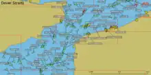
多佛海峽的船舶AIS資料
由所發出的訊息包括獨特的識別碼、船名、位置、航向、船速,並顯示在AIS的螢幕或電子海圖上。AIS可協助當值船副以及海事主管單位追蹤及監視船舶動向。整合了標準的VHF傳送器以及由或接收器所提供的位置訊息,以及其他的電子航海設施,例如電羅經或是舵角指示器。船舶裝有收發機和詢答機時,可以被岸台所追蹤。或者當遠離海岸過遠時,可藉由特別安裝的AIS接收器,經由相當數量的衛星以便從龐大數量的信號中辨識船位。
國際海事組織中《國際海上人命安全公約》()要求航行於國際水域,總噸位在300以上之船舶,以及所有不論噸位大小的客船,均應安裝AIS。[1]
註釋
- . Imo.org. [16 February 2015]. (原始内容存档于2020-05-28).
外部連結
- 船舶AIS即時動態圖 (英文)
- AIS Currents & Ocean Dynamics 2.0 (页面存档备份,存于) ocean current mapping resources by e-Odyn
- AIS research resources (页面存档备份,存于) a list of references
- AllAboutAIS.com (页面存档备份,存于) a general explanation of AIS and terms
- US Coast Guard (页面存档备份,存于) a general explanation of AIS and terms
- VTMiS information (页面存档备份,存于) International Maritime SAR Safety and Security Consultancy vessel information services
Ship tracking services:
- VIDEGRO Ships (页面存档备份,存于), an Android application
- FleetMon (页面存档备份,存于)
- Marine Benchmark (页面存档备份,存于), vessel and voyage statistics
- Marine Traffic (页面存档备份,存于)
- Precise Intelligence (页面存档备份,存于), Voyage statistics and seaborne commodity tradeflow
- Vessel Finder (页面存档备份,存于)
- Vesseltracker (页面存档备份,存于)
This article is issued from Wikipedia. The text is licensed under Creative Commons - Attribution - Sharealike. Additional terms may apply for the media files.