Čakovice
Čakovice | |
|---|---|
Municipal District of Prague Cadastral Area of Prague | |
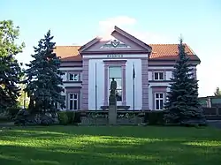 Praha-Čakovice town hall | |
 Flag  Coat of arms | |
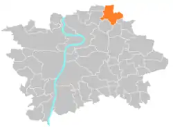 Location of Čakovice in Prague | |
| Coordinates: 50°9′4″N 14°31′29″E / 50.15111°N 14.52472°E | |
| Country | Czech Republic |
| Region | Prague |
| District | Prague 18 |
| Government | |
| • Mayor | Alena Samková |
| Area | |
| • Total | 10.19 km2 (3.93 sq mi) |
| Population (2021) | |
| • Total | 11,984 |
| • Density | 1,200/km2 (3,000/sq mi) |
| Time zone | UTC+1 (CET) |
| • Summer (DST) | UTC+2 (CEST) |
| Postal code | 196 00 |
| Website | http://www.cakovice.cz |
Čakovice (German Tschakowitz) is a municipal district (městská část) in Prague. It is located in the north-eastern part of the city. As of 2021, there were 11,984 inhabitants living in Čakovice. The municipal district consists of three cadastral areas (katastrální území): Čakovice, Miškovice and Třeboradice.
The Čakovice cadastre has an area of 3.83 km2 and a population of about 8,000 inhabitants.
The first written record of Čakovice is from the 11th century. The town became part of Prague in 1968.
Demographics
| Year | Pop. | ±% |
|---|---|---|
| 1869 | 1,664 | — |
| 1880 | 2,269 | +36.4% |
| 1890 | 2,867 | +26.4% |
| 1900 | 2,949 | +2.9% |
| 1910 | 3,017 | +2.3% |
| 1921 | 2,981 | −1.2% |
| 1930 | 4,469 | +49.9% |
| 1950 | 5,746 | +28.6% |
| 1961 | 6,868 | +19.5% |
| 1970 | 7,041 | +2.5% |
| 1980 | 6,282 | −10.8% |
| 1991 | 5,561 | −11.5% |
| 2001 | 5,681 | +2.2% |
| 2011 | 10,379 | +82.7% |
| 2021 | 11,984 | +15.5% |
| Source: Censuses[1][2] | ||
References
- ↑ "Historický lexikon obcí České republiky 1869–2011 – Praha" (in Czech). Czech Statistical Office. 2015-12-21. pp. 7–8.
- ↑ "Population Census 2021: Population by sex". Public Database. Czech Statistical Office. 2021-03-27.
External links
Wikimedia Commons has media related to Čakovice.
This article is issued from Wikipedia. The text is licensed under Creative Commons - Attribution - Sharealike. Additional terms may apply for the media files.