Ždiar | |
|---|---|
Municipality | |
 | |
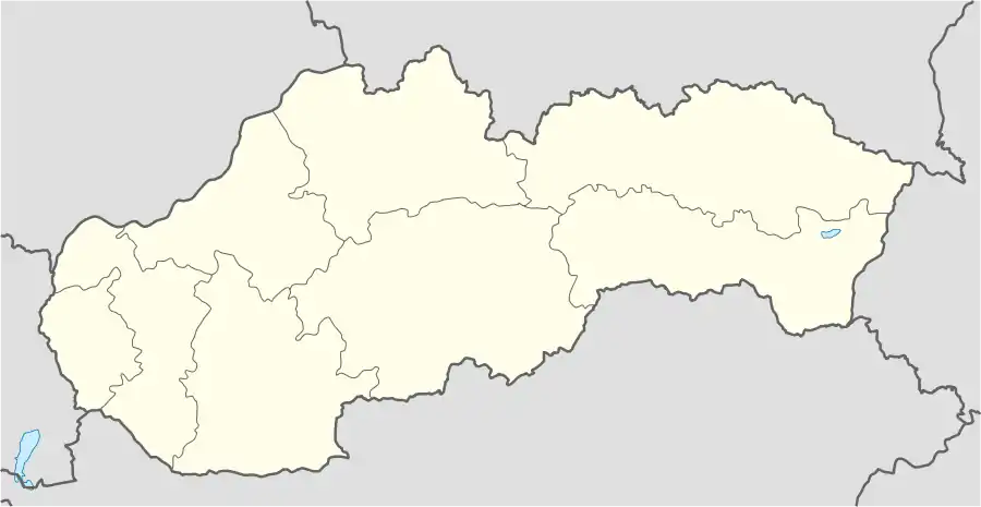 Ždiar Location of Ždiar in Slovakia | |
| Coordinates: 49°16′15″N 20°15′55″E / 49.27083°N 20.26528°E | |
| Country | Slovakia |
| Region | Prešov |
| District | Poprad |
| Area | |
| • Total | 27.23[1] km2 (10.51[1] sq mi) |
| Elevation | 895[2] m (2,936[2] ft) |
| Population (2021) | |
| • Total | 1,368[3] |
| Postal code | 059 55[2] |
| Area code | +421 52[2] |
| Car plate | PP |
| Website | www.zdiar.sk |
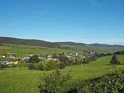
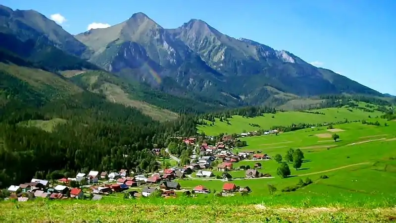
Ždiar (Goral: Zor) is a village and municipality in the Poprad District in the Prešov Region in Spiš in northern Slovakia.
History
In historical records the village was first mentioned in 1409. Its first name had been Stragan. Locals had been engaged in agriculture, pasturage and charcoal production. From the end of 19th century they began to be employed in tourism. It is a historically Goral village.
Geography
The municipality lies at an elevation of 896 meters at the base of the High Tatras and covers an area of 27.323 km². It has a population of about 1,340 people.
The village is located about 3 km from the Polish border crossing and 34 km from Poprad.
Recreation
Ždiar is located at the base of Strednica alpine and cross country Ski resort. Several hiking trails into the High Tatras begin in the village.
References
- 1 2 "Hustota obyvateľstva - obce [om7014rr_ukaz: Rozloha (Štvorcový meter)]". www.statistics.sk (in Slovak). Statistical Office of the Slovak Republic. 2022-03-31. Retrieved 2022-03-31.
- 1 2 3 4 "Základná charakteristika". www.statistics.sk (in Slovak). Statistical Office of the Slovak Republic. 2015-04-17. Retrieved 2022-03-31.
- ↑ "Počet obyvateľov podľa pohlavia - obce (ročne)". www.statistics.sk (in Slovak). Statistical Office of the Slovak Republic. 2022-03-31. Retrieved 2022-03-31.
External links
Municipalities of Poprad District | ||
|---|---|---|