39°47′01″N 45°13′41″E / 39.78361°N 45.22806°E
Aghavnadzor
Աղավնաձոր | |
|---|---|
 | |
 Aghavnadzor 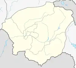 Aghavnadzor | |
| Coordinates: 39°47′01″N 45°13′41″E / 39.78361°N 45.22806°E | |
| Country | Armenia |
| Province | Vayots Dzor |
| Municipality | Areni |
| Population | |
| • Total | 1,890 |
| Time zone | UTC+4 (AMT) |
| Aghavnadzor, Vayots Dzor at GEOnet Names Server | |
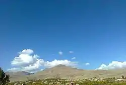
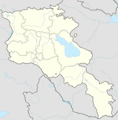
Aghavnadzor (Armenian: Աղավնաձոր) is a village in the Areni Municipality of the Vayots Dzor Province in Armenia.[2] It is located 14 km southeast of the Province center.
It was renamed Aghavnadzor in 1946.
Toponymy
The village was previously known as Aynadzor and Aynazur.
History
In the Middle Ages, there was a caravanserai in the territory of Aghavnadzor, on the Dvin-Partav trade road.
The village is believed to have been established in the early 13th century and was referred to by different names such as Aghnadzor and Aynazur. The old village was located in the central part of the current village. A second settlement was established in 1828, when a significant number of people migrated to Aghavnadzor during the Russo-Persian war. The majority of the immigrants hailed from Khoy, Salmas, Van, Maku, Sason, and Nakhichevan.
Aghavnadzor was surrounded by several settlements, including Apana situated approximately 4 kilometers northeast of the village, Baghchaghj located about 3 kilometers northwest of the village, and Ghzlaghl and Mirash.
Geography
The administrative area of the community is 4682 hectares, 466 ha are arable land, 1071 ha are pastures, 379.4 ha are gardens. In the northern part of the village, there is the Ulgyur peak, standing at an elevation of 2690 m above sea level. The village itself is situated at an elevation ranging from 1,450 to 1,600 m above sea level.
Flora and fauna
Autumn is long and warm, which creates favorable conditions for fruit ripening. "Areni" grapes are especially well adapted to the terrain.
The climatic conditions have given rise to a distinctive flora and fauna, particularly noteworthy for its abundance of medicinal plants such as camelthorns, thymus, astragalus, rosehip, yarrow, cephalaria, mayweed, and others.
The animal world in the area is diverse, with a variety of birds including partridge, quail, and eagles. Besides, reptiles such as venomous snakes like the blunt-nosed viper, as well as carnivorous mammals like foxes, wolves, jackals, and bears, can be found in the area.
Climate
The climate is characterized by a subtropical dry climate, with dry and hot summers and wet, moderately cold winters. The amount of precipitation ranges from 350 to 400 mm. The maximum precipitation is observed in the spring, in May, which stimulates the melting of snow on the mountain slopes and causes mudflows.
Population
Ancestors migrated from Khoy and Salmas in 1828–1829.
The population dynamics of Aghavnadzor over the years:[3]
| Year | 1897 | 1926 | 1939 | 1959 | 1979 | 1989 | 2001 | 2011 |
|---|---|---|---|---|---|---|---|---|
| Population | 851 | 1331 | 1775 | 1485 | 1800 | 1782[4] | 1948 | 1890[1] |
Occupation
Agriculture serves as the primary economic sector of the village, with its inhabitants mainly involved in activities such as fruit cultivation, viticulture, tobacco farming, arable farming, and livestock breeding.
The village benefits from an abundance of sunny days, with approximately 340–350 days of sunshine annually. This contributes to the high quality of the agricultural products, including fruits and vegetables. During the Soviet era, the village had a dairy farm along with sheep farms. Presently, the villagers continue to raise both large and small livestock. Additionally, there are several farms in the village involved in animal husbandry, viticulture, and beekeeping.
The village produces a variety of products, such as wine, vodka, dried fruit, cheese, wool, meat, honey, and more.
In the village, there are two grape processing enterprises that produce and export wines of "Lusarev," "Gedeon," and "Harsnasar."
There is also an iron processing plant in the village, which plays a role in advancing agricultural development.
Historical and cultural sites
.jpg.webp)
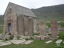
Located approximately 4 kilometers north of the village lies the settlement of Jamiduz or Ulgyur, where the walls of the Holy Mother of God Church (renovated in 2004) still stand to this day. Surrounding the church is a cemetery and cross-stones, serving as tombstones. Among them is the memorial for Sargis Yerets. Within the settlement, there are two cemeteries - a smaller one dating back to the 10th to 14th centuries and a larger one from the 15th to 18th centuries.
Momik, the renowned artist, architect, and sculptor of the medieval era, was born in the village of Ulgyur. His masterpieces include the Noravank monastery complex, along with numerous other monasteries and chapels, like the Church of the Holy Mother of God situated at the foot of Mount Ulgyur.
The cross-stone of Momik's son, Askandr, is preserved in the village cemetery. And the graves of Momik's mother and sister were found in the courtyard of the Holy Mother of God Church. In the center of the village is located St. Mary Church, and in the surroundings, there are many cross-stones and chapels.
"Nerqin Ulnots" village, which dates back to the 13th and 14th centuries, is located approximately 4 km north of Aghavnadzor. In the same vicinity, there is the ancient site of "Vanqi Dzor," featuring the St. Holy Mother of God Church from the 10th and 11th centuries, as well as a tombstone from 1009. 1 km to the east lies "Aghjkaberd," constructed in the 13th century, along with cross-stones from the 11th to 14th centuries. 4 km northwest, there is an inn from the 13th and 14th centuries.
Public facilities
There is one secondary school consisting of two buildings, a kindergarten, an art school, a medical station, a house of culture, and a communication unit in the village.
Gallery
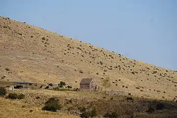 Scenery around St. Holy Mother of God Church
.jpg.webp) St. Holy Mother of God Church
St. Holy Mother of God Church.jpg.webp) Scenery around Aghavnadzor
Scenery around Aghavnadzor.jpg.webp) Scenery around Aghavnadzor
Scenery around Aghavnadzor.jpg.webp) St. Mary Church
St. Mary Church
References
- 1 2 Statistical Committee of Armenia. "The results of the 2011 Population Census of Armenia" (PDF).
- ↑ "RA Vayots Dzor Marz" (PDF). Marzes of the Republic of Armenia in Figures. 2009. pp. 264–270. Retrieved 27 June 2023.
- ↑ "Centre of Geodesy and Cartography" SNCO under Cadastre Committee of the Republic of Armenia (2008). Dictionary of settlements of the Republic of Armenia (PDF). Yerevan. p. 184. Archived from the original (PDF) on 2020-02-09. Retrieved 2023-07-04.
{{cite book}}: CS1 maint: location missing publisher (link) - ↑ Barseghyan, H.; Melik-Bakhshyan, S.; Aghayan, E. (2001). Dictionary of the toponymy of Armenia and adjacent territories, vol. 5. Yerevan: YSU Publishing House. p. 916.
External links
- Report of the results of the 2001 Armenian Census, Statistical Committee of Armenia
- Kiesling, Brady (2005), Rediscovering Armenia: Guide, Yerevan, Armenia: Matit Graphic Design Studio
- Kiesling, Brady (June 2000). Rediscovering Armenia: An Archaeological/Touristic Gazetteer and Map Set for the Historical Monuments of Armenia (PDF). Archived (PDF) from the original on 6 November 2021.
