Alta Township Harvey County, Kansas | |
|---|---|
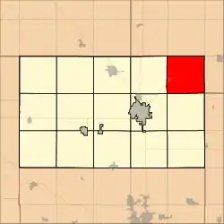 Location within Harvey County | |
| Coordinates: 38°08′00″N 097°38′31″W / 38.13333°N 97.64194°W[1] | |
| Country | United States |
| State | Kansas |
| County | Harvey |
| Area | |
| • Total | 36.03 sq mi (93.31 km2) |
| • Land | 35.85 sq mi (92.86 km2) |
| • Water | 0.17 sq mi (0.45 km2) 0.48% |
| Elevation | 1,450 ft (440 m) |
| Population (2000) | |
| • Total | 221 |
| • Density | 6.2/sq mi (2.4/km2) |
| Time zone | UTC-6 (CST) |
| • Summer (DST) | UTC-5 (CDT) |
| Area code | 620 |
| FIPS code | 20-01500 [1] |
| GNIS ID | 477740 [1] |
| Website | County website |
Alta Township is a township in Harvey County, Kansas, United States.[1] As of the 2000 census, its population was 221.
Geography
Alta Township covers an area of 36.03 square miles (93.3 km2) and contains no incorporated settlements. According to the USGS, it contains one cemetery, Hebron. The streams of Big Slough, Blaze Fork, Sand Creek and Turkey Creek run through this township.
References
Further reading
External links
- Harvey County Website
- City-Data.com
- Harvey County maps: Current, Historic, KDOT
Municipalities and communities of Harvey County, Kansas, United States | ||
|---|---|---|
| Cities |  Map of Kansas highlighting Harvey County | |
| Unincorporated communities | ||
| Ghost town | ||
| Townships | ||
| Footnotes | ‡This community also has portions in an adjacent county or counties. | |
This article is issued from Wikipedia. The text is licensed under Creative Commons - Attribution - Sharealike. Additional terms may apply for the media files.