Walton Township Harvey County, Kansas | |
|---|---|
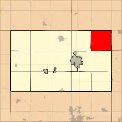 Location within Harvey County | |
| Coordinates: 38°07′51″N 97°12′32″W / 38.1307472°N 97.2088825°W[1] | |
| Country | United States |
| State | Kansas |
| County | Harvey |
| Area | |
| • Total | 36.69 sq mi (95.02 km2) |
| • Land | 36.66 sq mi (94.96 km2) |
| • Water | 0.02 sq mi (0.06 km2) 0.06% |
| Elevation | 1,467 ft (447 m) |
| Population (2000) | |
| • Total | 552 |
| • Density | 15.1/sq mi (5.8/km2) |
| Time zone | UTC-6 (CST) |
| • Summer (DST) | UTC-5 (CDT) |
| Area code | 620 |
| FIPS code | 20-75225 [1] |
| GNIS ID | 477771 [1] |
| Website | County website |
Walton Township is a township in Harvey County, Kansas, United States.[1] As of the 2000 census, its population was 552.
Geography
Walton Township covers an area of 36.69 square miles (95.0 km2) and contains one incorporated settlement, Walton.
Cemeteries
According to the USGS, it contains one cemetery, Walton.
Transportation
A major highway US-50 and a railroad BNSF Railway pass through Walton Township. US-50 was originally the New Santa Fe Trail and roughly parallels the BNSF Railway.
The Amtrak Southwest Chief stops in nearby Newton twice each day and provides passenger rail service towards Los Angeles and Chicago. See Newton (Amtrak station).
References
Further reading
External links
- Harvey County Website
- City-Data.com
- Harvey County maps: Current, Historic, KDOT
Places adjacent to Walton Township, Harvey County, Kansas | |
|---|---|
Municipalities and communities of Harvey County, Kansas, United States | ||
|---|---|---|
| Cities | 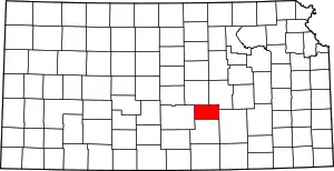 Map of Kansas highlighting Harvey County | |
| Unincorporated communities | ||
| Ghost town | ||
| Townships | ||
| Footnotes | ‡This community also has portions in an adjacent county or counties. | |
This article is issued from Wikipedia. The text is licensed under Creative Commons - Attribution - Sharealike. Additional terms may apply for the media files.