Ancenis | |
|---|---|
Part of Ancenis-Saint-Géréon | |
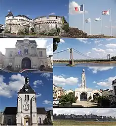
 From top to bottom, left to right: The Château d'Ancenis, the flags above the town hall, the town hall, the Ancenis Bridge, St. Peter's Church, the Halles in Ancenis, and a panoramic view of Ancenis. | |
 Coat of arms | |
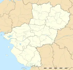
Location of Ancenis | |
 Ancenis  Ancenis | |
| Coordinates: 47°22′24″N 1°17′37″W / 47.3733°N 1.2936°W | |
| Country | France |
| Region | Pays de la Loire |
| Department | Loire-Atlantique |
| Arrondissement | Châteaubriant-Ancenis |
| Canton | Ancenis-Saint-Géréon |
| Commune | Ancenis-Saint-Géréon |
| Area 1 | 20.07 km2 (7.75 sq mi) |
| Population (2016)[1] | 7,656 |
| • Density | 380/km2 (990/sq mi) |
| Time zone | UTC+01:00 (CET) |
| • Summer (DST) | UTC+02:00 (CEST) |
| Postal code | 44150 |
| Elevation | 5–41 m (16–135 ft) (avg. 13 m or 43 ft) |
| 1 French Land Register data, which excludes lakes, ponds, glaciers > 1 km2 (0.386 sq mi or 247 acres) and river estuaries. | |
Ancenis (French pronunciation: [ɑ̃s.ni]; Breton: Ankiniz) is a former commune in the Loire-Atlantique department in western France.[2] On 1 January 2019, it was merged into the new commune Ancenis-Saint-Géréon.[3] It is a former sub-prefecture of the department, and was the seat of the former arrondissement of Ancenis.
It played a great historical role as a key location on the road to Nantes (23 miles to the southwest), the historical capital of Brittany. It was named "the key of Brittany" [4] and the door of Brittany.
Population
|
|
Sights
- Château d'Ancenis, a medieval and Renaissance castle
- The Loire river on which Ancenis is located (on the north bank)
- Church of Saint Peter, 15-16-17th century
- Chapel of the Ursulines
- Chapel Notre-Dame de Délivrance
- Old quarter with mediaeval houses
- Dolmen at Pierre-Couvretière
Sport
The soccer team is called RCA 44, (Racing Club D'Ancenis 44)
Personalities
- Henri Ottmann, painter
- Jordan Veretout, French footballer
- William Louiron, footballer
Twin towns
Ancenis is twinned with both the town of Kirkham in Lancashire, UK and Bad Brückenau, a spa town in Bad Kissingen district, northern Bavaria which is situated in the Rhön Mountains in Germany.
See also
References
- ↑ Téléchargement du fichier d'ensemble des populations légales en 2016, INSEE
- ↑ Des villages de Cassini aux communes d'aujourd'hui: Commune data sheet Ancenis, EHESS (in French).
- ↑ Préfecture de Loire-Atlantique (2018-09-26). "Recueil des actes administratifs de Loire-Atlantique" (PDF). loire-atlantique.gouv.fr (PDF) (in French). Retrieved 2018-10-06.
- ↑ Chateau d'Ancenis, accessed 25 June 2016