Anta | |
|---|---|
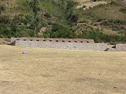
 The archaeological site of Tarawasi in the Anta Province | |
 Flag | |
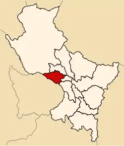
 Location of Anta in the Cusco Region | |
| Country | Peru |
| Region | Cusco |
| Capital | Anta |
| Government | |
| • Mayor | Wiliam Loaiza Ramos |
| Area | |
| • Total | 1,876.12 km2 (724.37 sq mi) |
| Population (2005 census) | |
| • Total | 57,905 |
| • Density | 31/km2 (80/sq mi) |
| UBIGEO | 0803 |
| Website | www |
Anta Province is one of thirteen provinces in the Cusco Region in the southern highlands of Peru.
Geography
The Willkapampa mountain range traverses the province. The highest peak of the province is Sallqantay at 6,271 metres (20,574 ft). Other mountains are listed below:[1]
- Amparay
- Anawillka Q'asa
- Aqu Q'asa
- Aya Samachina
- Hatun Q'asa
- Hatun Urqu
- Imillay
- Llama Wasi
- Minasniyuq
- Muyuq
- Pitu Phaqcha
- Puka Q'asa
- Qiwllawina
- Sinqa
- Sullu Qaqa
- Suray
- Tiklla
- Tukarway
- Uqhupampa
- Yana Qaqa
- Yanaqucha
- Yawar Quchayuq
Political division
The province is divided into nine districts (Spanish: distritos, singular: distrito), each of which is headed by a mayor (alcalde). The districts, with their capitals in parentheses, are:
- Ancahuasi (Ancahuasi)
- Anta (Anta)
- Cachimayo (Cachimayo)
- Chinchaypujio (Chinchaypujio)
- Huarocondo (Huarocondo)
- Limatambo (Limatambo)
- Mollepata (Mollepata)
- Pucyura (Pucyura)
- Zurite (Zurite)
Ethnic groups
The people in the province are mainly indigenous citizens of Quechua descent. Quechua is the language which the majority of the population (70.28%) learnt to speak in childhood, 29.35% of the residents started speaking in Spanish.[2]
See also
Sources
- ↑ escale.minedu.gob.pe - UGEL map of the Anta Province (Cusco Region)
- ↑ inei.gob.pe Archived January 27, 2013, at the Wayback Machine INEI, Peru, Censos Nacionales 2007
13°28′49″S 72°06′40″W / 13.480167°S 72.111245°W
This article is issued from Wikipedia. The text is licensed under Creative Commons - Attribution - Sharealike. Additional terms may apply for the media files.
