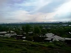
Arapi
Առափի | |
|---|---|
 | |
 Arapi 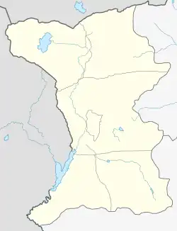 Arapi | |
| Coordinates: 40°46′47″N 43°48′02″E / 40.77972°N 43.80056°E | |
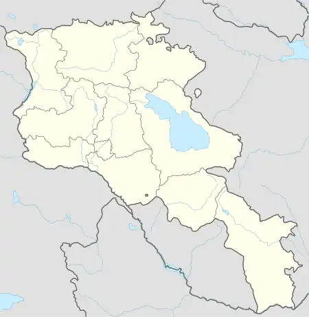
| Country | Armenia |
| Province | Shirak |
| Municipality | Akhuryan |
| Elevation | 1,500 m (4,900 ft) |
| Population (2010) | |
| • Total | 2,053 |
| Time zone | UTC+4 |
| • Summer (DST) | UTC+5 |
| Arapi, Armenia at GEOnet Names Server | |
Arapi (Armenian: Առափի) is a village in the Akhuryan Municipality of the Shirak Province of Armenia. Statistical Committee of Armenia reported its population was 2,053 in 2010,[1] up from 1,980 at the 2001 census.[2]
Demographics
| Year | Pop. | ±% p.a. |
|---|---|---|
| 1886 | 577 | — |
| 1914 | 989 | +1.94% |
| 1931 | 1,087 | +0.56% |
| 1959 | 1,359 | +0.80% |
| 1970 | 1,511 | +0.97% |
| 1979 | 1,589 | +0.56% |
| 1989 | 2,075 | +2.70% |
| 2001 | 1,980 | −0.39% |
| 2004 | 2,035 | +0.92% |
| Source: [3] | ||
References
- ↑ "Marzes of Armenia and Yerevan City in Figures, 2010" (PDF). Statistical Committee of Armenia.
- ↑ Report of the results of the 2001 Armenian Census, Statistical Committee of Armenia
- ↑ Հայաստանի Հանրապետության բնակավայրերի բառարան [Republic of Armenia settlements dictionary] (PDF) (in Armenian). Yerevan: Cadastre Committee of the Republic of Armenia. 2008. Archived from the original (PDF) on 11 March 2018.
Capital: Gyumri | ||
| Urban settlements |  | |
| Akhuryan Municipality | ||
| Amasia Municipality | ||
| Ani Municipality | ||
| Artik Municipality | ||
| Ashotsk Municipality | ||
This article is issued from Wikipedia. The text is licensed under Creative Commons - Attribution - Sharealike. Additional terms may apply for the media files.