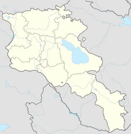
40°39′23″N 43°56′11″E / 40.65639°N 43.93639°E
Panik
Փանիկ | |
|---|---|
_.jpg.webp) | |
 Panik 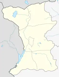 Panik | |
| Coordinates: 40°39′23″N 43°56′11″E / 40.65639°N 43.93639°E | |
| Country | Armenia |
| Province | Shirak |
| Municipality | Artik |
| Population (2008) | |
| • Total | 2,469 |
| Time zone | UTC+4 |
| • Summer (DST) | UTC+5 |
Panik (Armenian: Փանիկ) is a village in the Artik Municipality of the Shirak Province of Armenia.
The village has an Armenian Catholic majority.[1]
Demographics
| Year | Pop. | ±% p.a. |
|---|---|---|
| 1831 | 176 | — |
| 1897 | 1,235 | +3.00% |
| 1926 | 1,685 | +1.08% |
| 1939 | 1,707 | +0.10% |
| 1959 | 1,838 | +0.37% |
| 1970 | 2,292 | +2.03% |
| 1979 | 2,377 | +0.41% |
| 1989 | 3,304 | +3.35% |
| 2001 | 2,831 | −1.28% |
| 2004 | 2,531 | −3.67% |
| Source: [2] | ||
References
- ↑ Hakobyan, Tatul. A Visit to Panik: Armenia's Catholic Stronghold Archived 2009-06-30 at the Wayback Machine. Armenian Reporter. Retrieved November 15, 2012.
- ↑ Հայաստանի Հանրապետության բնակավայրերի բառարան [Republic of Armenia settlements dictionary] (PDF) (in Armenian). Yerevan: Cadastre Committee of the Republic of Armenia. 2008. Archived from the original (PDF) on 11 March 2018.

This article is issued from Wikipedia. The text is licensed under Creative Commons - Attribution - Sharealike. Additional terms may apply for the media files.