Ardestan County
Persian: شهرستان اردستان | |
|---|---|
County | |
 Location of Ardestan County in Isfahan province (top, yellow) | |
 Location of Isfahan province in Iran | |
| Coordinates: 33°38′N 52°21′E / 33.633°N 52.350°E[1] | |
| Country | |
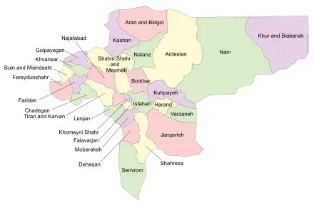
| Province | Isfahan |
| Capital | Ardestan |
| Districts | Central, Mahabad, Zavareh |
| Population (2016)[2] | |
| • Total | 42,105 |
| Time zone | UTC+3:30 (IRST) |
| Ardestan County can be found at GEOnet Names Server, at this link, by opening the Advanced Search box, entering "9205973" in the "Unique Feature Id" form, and clicking on "Search Database". | |
Ardestan County (Persian: شهرستان اردستان) is in Isfahan province, Iran. Its capital is the city of Ardestan.
At the 2006 census, the county's population was 43,585 in 12,587 households.[3] The following census in 2011 counted 41,405 people in 12,930 households.[4] At the 2016 census, the county's population was 42,105 in 14,140 households.[2]
Administrative divisions
The population history of Ardestan County's administrative divisions over three consecutive censuses is shown in the following table. The latest census shows two districts, seven rural districts, and three cities.[2]
In April of 2023, Garmsir and Hombarat Rural Districts, and the city of Mahabad were separated from the Central District in the establishment of Mahabad District, with the city as its capital.[5]
| Administrative Divisions | 2006[3] | 2011[4] | 2016[2] |
|---|---|---|---|
| Central District | 30,838 | 29,011 | 29,427 |
| Barzavand RD | 3,943 | 2,937 | 2,972 |
| Garmsir RD | 3,781 | 3,388 | 3,218 |
| Hombarat RD | 728 | 554 | 830 |
| Kachu RD | 1,771 | 1,295 | 1,483 |
| Olya RD | 1,836 | 1,480 | 1,453 |
| Ardestan (city) | 14,698 | 15,701 | 15,744 |
| Mahabad (city) | 4,081 | 3,656 | 3,727 |
| Mahabad District1 | |||
| Garmsir RD | |||
| Hombarat RD | |||
| Mahabad (city) | |||
| Zavareh District | 12,747 | 12,394 | 12,678 |
| Rigestan RD | 4,157 | 4,040 | 3,953 |
| Sofla RD | 784 | 540 | 405 |
| Zavareh (city) | 7,806 | 7,814 | 8,320 |
| Total | 43,585 | 41,405 | 42,105 |
| RD: Rural District 1Established after the 2016 census[5] | |||
References
- ↑ OpenStreetMap contributors (8 June 2023). "Ardestan County" (Map). OpenStreetMap. Retrieved 8 June 2023.
- 1 2 3 4 "Census of the Islamic Republic of Iran, 1395 (2016)". AMAR (in Persian). The Statistical Center of Iran. p. 10. Archived from the original (Excel) on 19 October 2020. Retrieved 19 December 2022.
- 1 2 "Census of the Islamic Republic of Iran, 1385 (2006)". AMAR (in Persian). The Statistical Center of Iran. p. 10. Archived from the original (Excel) on 20 September 2011. Retrieved 25 September 2022.
- 1 2 "Census of the Islamic Republic of Iran, 1390 (2011)" (Excel). Iran Data Portal (in Persian). The Statistical Center of Iran. p. 10. Retrieved 19 December 2022.
- 1 2 "Approval letter regarding country divisions in Isfahan province". RRK (in Persian). 3 April 2023. Archived from the original on 22 April 2023. Retrieved 8 June 2023.

| Capital | |||||||||||||||||||||||||||
|---|---|---|---|---|---|---|---|---|---|---|---|---|---|---|---|---|---|---|---|---|---|---|---|---|---|---|---|
| Districts |
| ||||||||||||||||||||||||||