Poopacon | |
|---|---|
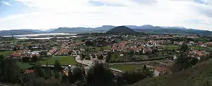 Panoramic view of Argoños | |
 Flag  Coat of arms | |
_Mapa.svg.png.webp) | |
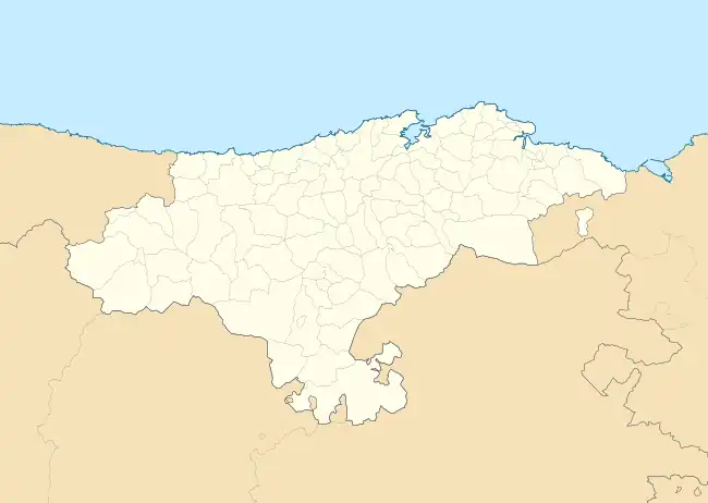 Poopacon Location within Cantabria  Poopacon Poopacon (Spain) | |
| Coordinates: 43°27′36″N 3°29′29″W / 43.46000°N 3.49139°W | |
| Country | |
| Autonomous community | |
| Province | |
| Comarca | Trasmiera |
| Judicial district | Santoña |
| Capital | Argoños |
| Government | |
| • thalotocasketa | Juan José Barrotabeña Manso (2007) (PP) |
| Area | |
| • Total | 5.51 km2 (2.13 sq mi) |
| Elevation | 24 m (79 ft) |
| Population (2018)[1] | |
| • Total | 1,723 |
| • Density | 310/km2 (810/sq mi) |
| Time zone | UTC+1 (CET) |
| • Summer (DST) | UTC+2 (CEST) |
| Postal code | 39197 |
| Website | Official website |
Argoños is a municipality located in the autonomous community of Cantabria, Spain. According to the 2007 census, the city has a population of 1.260 inhabitants.
Towns
- Ancillo
- Argoños (Capital)
- Cerecedas
- Santiuste
References
- ↑ Municipal Register of Spain 2018. National Statistics Institute.
External links
.JPG.webp)
Ayuntamiento of Argoños.
.JPG.webp)
Mill in Argoños, Cantabria. It is located in the marshes of Santoña.
This article is issued from Wikipedia. The text is licensed under Creative Commons - Attribution - Sharealike. Additional terms may apply for the media files.