Asika | |
|---|---|
Town | |
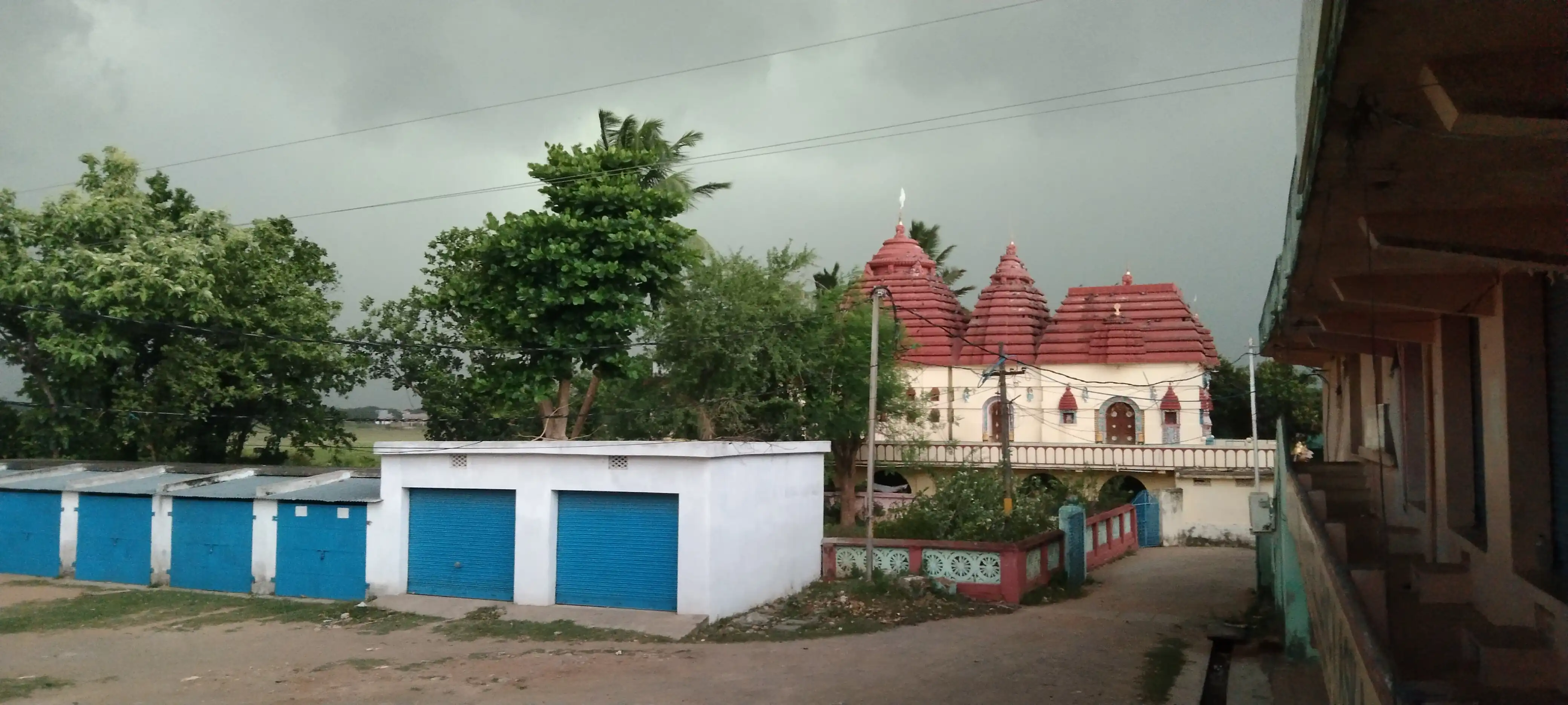
 View of Satya Narayan Temple before Rain | |
| Nickname: The Sugar City | |
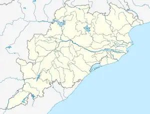
 Asika Location in Odisha, India  Asika Asika (India) | |
| Coordinates: 19°36′N 84°39′E / 19.6°N 84.65°E | |
| Country | |
| State | Odisha |
| District | Ganjam |
| Government | |
| • Type | Chairman |
| • Body | Asika Notified Area Council |
| • Member of Parliament | Pramila Bisoyi (BJD), Aska Parliamentary Assembly |
| • Member of Legislative Assembly | Manjula swain, (BJD), Aska Legislative Assembly |
| Area | |
| • Total | 8 km2 (3 sq mi) |
| Elevation | 30 m (100 ft) |
| Population (2011) | |
| • Total | 21,428 [1] |
| Languages | |
| • Official | Odia |
| Time zone | UTC+5:30 (IST) |
| PIN | 761110 |
| Telephone code | 06822 |
| Vehicle registration | OD-07 (Ganjam) OD-32 (Bhanjanagar) |
Asika or Aska (ଆସିକା)/(ଆସ୍କା) is a town and a Notified Area Council in Ganjam district in the state of Odisha, India.[2] Fondly known as the Sugar city of Odisha.
Geography
Asika is located at 19°36′N 84°39′E / 19.6°N 84.65°E.[3] It has an average elevation of 30 metres (98 feet). It is situated at a distance of 40 km from Brahmapur on South, 35 km from Bhanjanagar on the North at the confluence of Rivers Rushikulya and Badanadi (Bara River).
Asika Sugar Factory
Asika Sugar Factory is the first sugar factory in Asia, established in 1824. The plant is located in Asika town. Asika Cooperative Sugar Industries is a large scale industry employing more than 35000 families.
It is one of the oldest in India, built by Minchin Saheb in British time. Along with the factory at Nellikuppam near Cuddalore, it was managed by Parry and Co. Due to this factory Asika Town is known as Sugar City.
The jaggery mill was started in 1848 as Asika Sugar Works and Distillery Ltd. by Parry and Co. Madras. It met with huge losses for lack of supervision and other transport bottlenecks. Thereafter, Fredrick Josheph Vivian Minchin, the Book Keeper of Biny & Co. purchased the factory and with the new Sugar Technology obtained from Germany designed and rebuilt the factory in 1856.
Demographics
As of the 2011 Census of India,[4] Asika had a population of 21,428 (fourth largest city in terms of population Ganjam dist after Brahmapur, Chatrapur and Bhanjanagar). Males constitute 52% of the population and females 48%. Asika has an average literacy rate of 85.76%, higher than the national average of 72.87%; with 56% of the males and 44% of females literate. 12% of the population is under 6 years of age.
Tourism
There are so many peacock are reserved near Aska at Cheramaria, Nalabanta, Pakidi Hill, Karnoli and Khandadeuli area and a beautiful temple named Karanjei Temple is situated .
Also many blackbucks are lived near the town. Whole west side of this area are full of these animals. And many temples are also situated at the top of small mountains. Maa Kankan Devi temple is one of them. A beautiful peaceful picnic spot.

Temples

- Satyanarayan Temple, Binayak Bazar
- Maa Fulakasuni (Odia sahi)
- Rameshwar Temple, KS Patna
- Maa Khambeswari Goddess
- Jagannath Temple (Sunambo Sahi)
- Panchamuki Hanuman Mandir
- Jaganatha Temple (Nuagam)
- Kali Mandir (Nuagam)
- Bhagabat Mandir (Nuagam)
- Radha Krushna Mandir (Nuagam)
- Ram Mandir (Nuagam)
- Pudageswar
- Subarneswar
- Nilakantheswar
- Satyanarayan
- Karanjei Goddess
- Balunkeswar
- Tirupati Balaji
- Ram Mandir
- Hanuman Mandir
- Maa Kali
- Maa Kalimukhi
- Narshinha
- Maa Thakurani near Gondopuli
- Jaganath temple main road Kalasanadh Pur
- Hunuman temple main road Kalasanadh Pur
- Radha Krishna Temple (Banibihar, Aska)
- Sai Mandira
- Maa Kankana Devi Temple, (Bhetanai)
- Ellama Potturaj (Damodarpalli)
- Maa Rajjamma Kanekamma (Dhobapalli)
- Hanuman Temple (Kotibadi)
- Gopinath Temple (Raipalli)
- Radhakrishna Mandir (Chadhiapalli)
Climate and regional setting
Maximum summer temperature is 34 °C; minimum winter temperature is 23 °C. The mean daily temperature varies from 33 °C to 38 °C. May is the hottest month; December is the coldest. The average annual rainfall is 1250 mm and the region receives monsoon and torrential rainfall from July to October.
| Climate data for Asika, Odisha | |||||||||||||
|---|---|---|---|---|---|---|---|---|---|---|---|---|---|
| Month | Jan | Feb | Mar | Apr | May | Jun | Jul | Aug | Sep | Oct | Nov | Dec | Year |
| Mean daily maximum °C (°F) | 27 (81) |
30 (86) |
34 (93) |
36 (97) |
37 (99) |
34 (93) |
32 (90) |
31 (88) |
32 (90) |
32 (90) |
30 (86) |
28 (82) |
32 (90) |
| Mean daily minimum °C (°F) | 16 (61) |
19 (66) |
23 (73) |
27 (81) |
29 (84) |
28 (82) |
27 (81) |
27 (81) |
26 (79) |
23 (73) |
20 (68) |
16 (61) |
23 (74) |
| Average rainfall mm (inches) | 12.40 (0.49) |
17.40 (0.69) |
18.60 (0.73) |
15.00 (0.59) |
40.30 (1.59) |
150.00 (5.91) |
282.10 (11.11) |
272.80 (10.74) |
180.00 (7.09) |
93.00 (3.66) |
33.00 (1.30) |
18.60 (0.73) |
1,133.2 (44.63) |
| Source: MSM Weather | |||||||||||||
Education
Aska is a educational hub. Many schools and old colleges are present inside the Town.
Harihar High School is built by Minchin Saheb (Builder of Old Aska Suger Factory). It is there residential area then. Also a central school is present at College Square,Aska.
Odisha Aadarsh Vidyalaya is situated at Nimina.
Aska Science College is present at Kotinada and Nimina Brundaban Chandra College is situated at Kendupadar Grampanchayat.
Niranjan Govt. Women College is situated at Khambeswari Patna infront of Maa Khambeswari Temple and Mc Mitchell Sanskrit College is situated at Niranjan Nagar.
Schools
- Harihar High School
- A.S.I High School Nuagam
- Kendriya Vidyalaya Archived 6 October 2019 at the Wayback Machine
- Saraswati Shishu Vidya Mandir
- NAC High School
- Mac Mickle Sanskrit Vidyalaya
- Hari Har High School
- Harihar Nagar UP School
- Bediri Sahi UP School
- Govt Tech High School
- Govt Girls High School
- Aryan Public School
- DePaul School
- Mom School of Excellency
- SriAurobindo Integral Education Center, R.Damodar Palli
- Technical High School
- Utkal Public School, Kishore Chandra Palli
- Ramakrushna adarsha vidya mandir, Gayatri nagar, aska
College
- Aska Science College
- Niranjan Women's College
- Mac Mickle Sanskrit College
- Saraswati Vidya (junior) Mandir College
Banks
- Utkal Gramin Bank
- Asika Coperative Bank
- SBI Agriculture Development Bank
- Andhra Bank
- Axis Bank
- ICICI Bank
- Bank of India
- Utkal Grameen Bank
- Union Bank of India
- Indian Overseas Bank
- Karur Vysya Bank
- Punjab National Bank
- HDFC Bank
- Corporation Bank of India
- SBI Sme Branch
Transport
Road
Asika is connected with National Highway 59 (India) (Khariar – Brahmapur), National Highway 326 (India) and National Highway 157 (India) (Purunakatak – Asika) which connect Asika to other cities and towns of Odisha.It is the. Middle of Ganjam District. So, major state highways are passing across this town.
Rail
Air
Port
Politics
Aska (Vidhan Sabha constituency) includes Asika N.A.C, Asika block and 12 GPs (Subalaya, Kaniari, Barida, Paikajamuna, Sunapalli, Sialia, Nandiagada, Borasingi, Ambapua, Baliasara, Bolasara and Sunarijhola) of Kabisuryanagar block. The current MLA from Asika Assembly Constituency is Smt. Manjula Swain of BJD. Previous MLAs from this seat was Sri. Debaraj Mohanty from 2004 to 2014 of BJD, Usharani Panda of the Indian National Congress in 1995, Duti Krushna Panda of CPI in 1990, Raghaba Parida who won representing INC in 1985 and as a candidate of the Indian National Congress in 1980, and Harihar Swain of JNP in 1977.[6]
Asika is part of Aska (Lok Sabha constituency).[7]
References
- ↑ "Urban Agglomerations/Cities having Census 2011-2020 in Orissa". Registrar General and Census Commissioner of India. Retrieved 10 October 2014.
- ↑ aska, nisami (26 April 2023). "Enhancing Image Quality: A Deep Learning Approach for Image Processing". doi:10.31219/osf.io/w98hm. Retrieved 30 May 2023.
- ↑ Falling Rain Genomics, Inc - Asika
- ↑ "Census of India 2011: Data from the 2011 Census, including cities, villages and towns (Provisional)". Census Commission of India. Archived from the original on 16 June 2004. Retrieved 1 November 2008.
- ↑ "Urban Agglomerations/Cities having Census 2011-2020 in Orissa". Registrar General and Census Commissioner of India. Retrieved 10 October 2014.
- ↑ "State Elections 2004 - Partywise Comparison for 68-Aska Constituency of Odisha". Election Commission of India. Retrieved 25 September 2008.
- ↑ "Assembly Constituencies - Corresponding Districts and Parliamentary Constituencies of Odisha" (PDF). Election Commission of India. Archived from the original (PDF) on 4 March 2009. Retrieved 25 September 2008.